14R: Brown's Mount,
The Fall Line,
Elevations,
Uplifts,
& Native Middle Georgians
By Thomas Thurman
Posted 24/June/2023
Sand Dollars & Seashells
High Above Macon
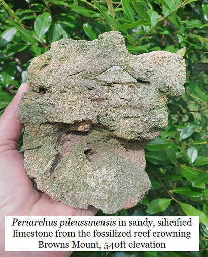
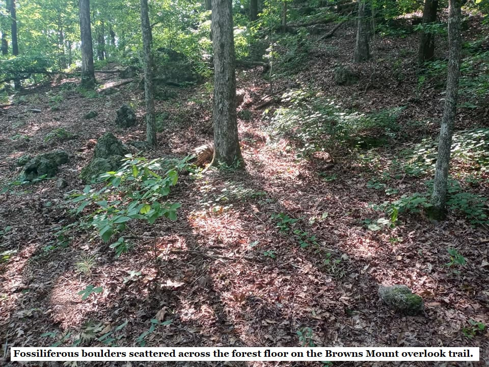
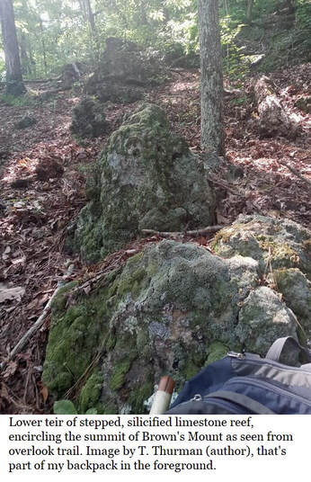
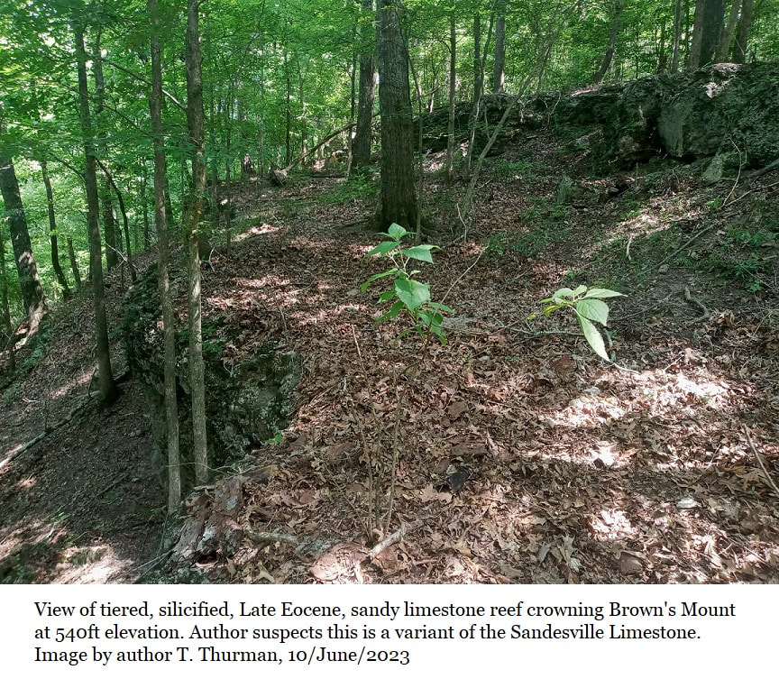
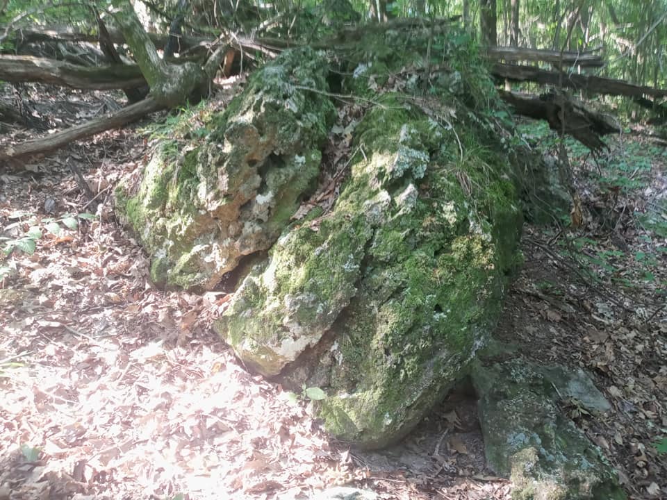
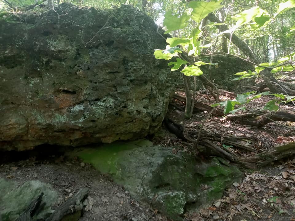
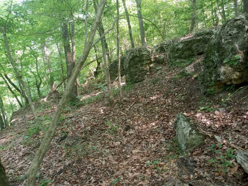
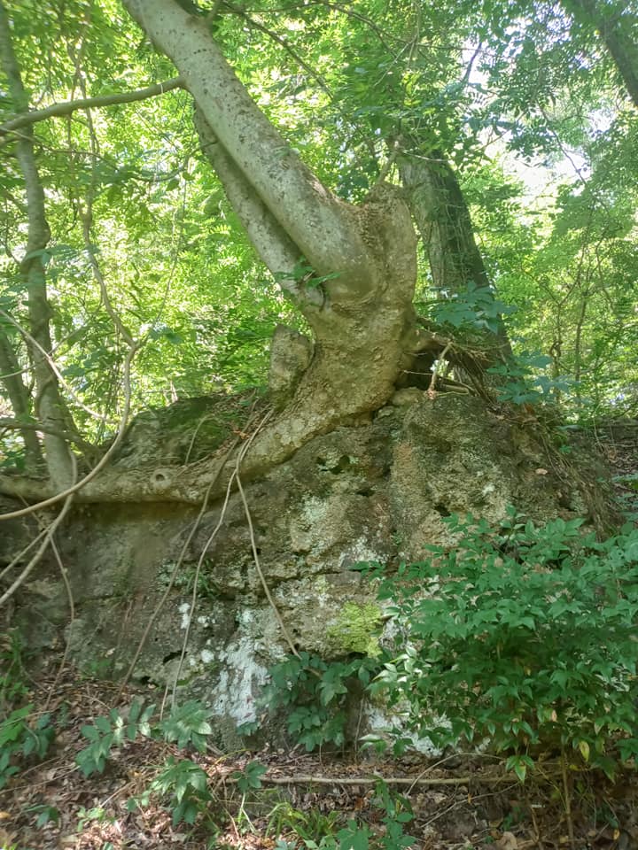
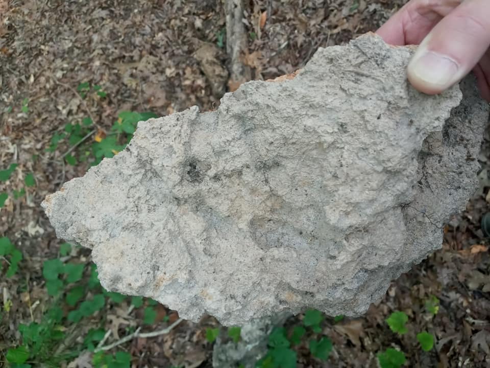
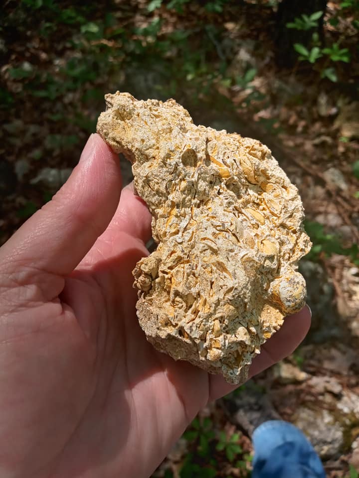
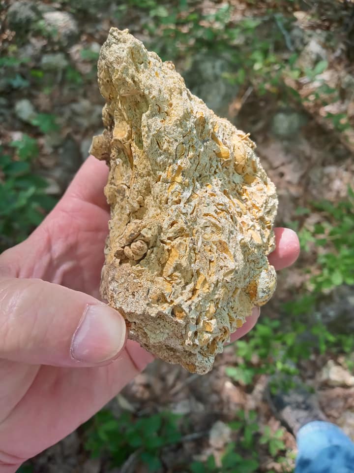
Brown's Mount stands on the east bank of the Ocmulgee River just south of downtown Macon in Bibb County. It’s crowned by a fossilized reef, complete with sand dollars, almost encircling its summit. This ia a silicified limestone reef, and it stands 540ft over Central Georgia’s northern Coastal Plain. It formed, of course, when Brown’s Mount was completely submerged beneath the waves of a warm tropical sea.
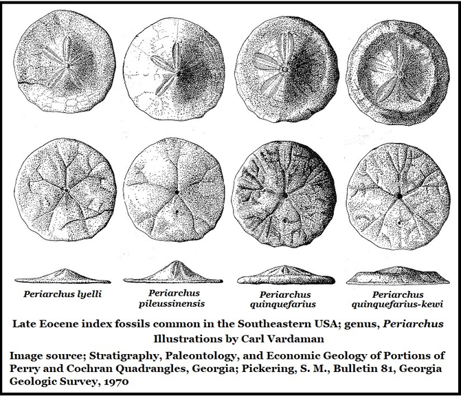
The sand dollars are Periarchus pileussinensis, a species that went extinct 34 million years ago. This is a Late Eocene index fossil, meaning we know accurately when the genus emerged and when it went extinct. So whenever you see it you know you’re looking at Late Eocene sediments. This gives us a firm, indisputable upper age for the reef. It cannot be younger that the 34 million year old fossils it contains.
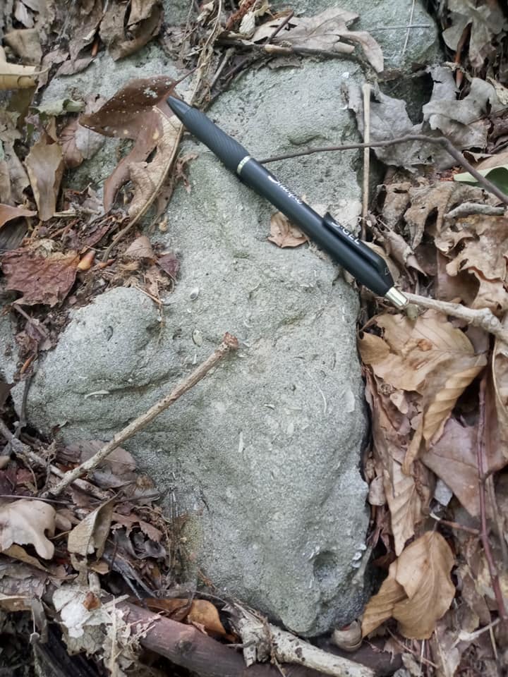
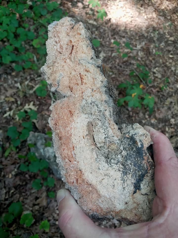
This silicified limestone doesn’t compare well with the Coastal Plain’s other Late Eocene limestones. It’s much sandier, in some places it looks more like a sandstone than a limestone and the suite of fossils is also different. But below the reef one finds more familiar, densely fossiliferous rocks ranging from dornicks (hand samples) to small boulders. These are also silicified but easily recognizable as a variant of the Clinchfield Formation. The Clinchfield Formation is well known and research from multiple sources dates it to roughly 35.5 million years old. Its presence below the limestone reef tells us a minimum possible age for the reef. It cannot be older than 35.5 million years.
Elevation
Google Earth puts the summit at 540 feet. Topographical maps put the summit at 550 feet. Handheld GPS and cell phones might say anywhere from 490 to 566 feet. For simplicity’s sake, and the sake of this essay, we’ll use Google Earth for all elevation figures since those are most easily accessed by the reader.
Google Earth puts the summit at 540 feet. Topographical maps put the summit at 550 feet. Handheld GPS and cell phones might say anywhere from 490 to 566 feet. For simplicity’s sake, and the sake of this essay, we’ll use Google Earth for all elevation figures since those are most easily accessed by the reader.
Sir Charles Lyell
The father of modern geology, Sir Charles Lyell, visited Macon and Brown’s Mount. He’s the author of Principals of Geology (1830) which first presented the scientific concept that the Earth was shaped by the same natural processes seen in operation today (Uniformitarianism). He was also a close friend, mentor, and advisor to Charles Darwin.
Lyell made two visits to the USA. He visited Brown’s Mount during the 1840s and wrote about the artifacts and fossils he saw and collected there. His books include Travels to North America (1845) and A Second Visit to the United States of North America (1849).
Location & Habitation
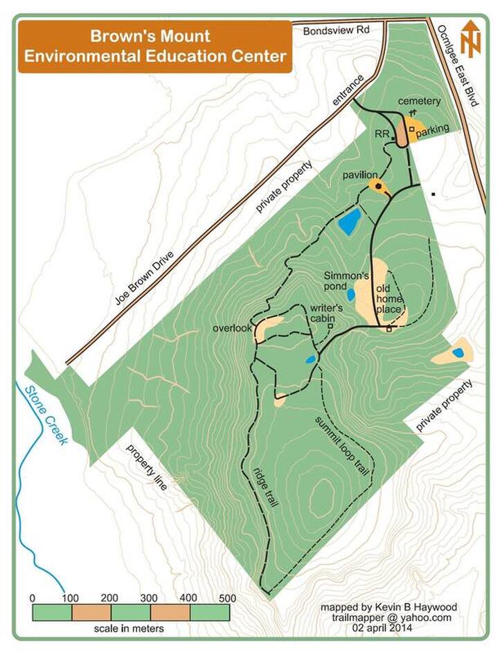
The summit is less than a mile east of the Ocmulgee River and about 2 miles south of the Fall Line. It stands five miles southeast of downtown Macon and it’s 4.7 miles due south of the Great Temple Mound and Ocmulgee National Monument, mounds which have known continuous human habitation for 12,000 years. The same is believed to be true of Brown’s Mount. It's vantage point above the Ocmulgee River would have valued by native Georgians.
The summit is less than a mile east of the Ocmulgee River and about 2 miles south of the Fall Line. It stands five miles southeast of downtown Macon and it’s 4.7 miles due south of the Great Temple Mound and Ocmulgee National Monument, mounds which have known continuous human habitation for 12,000 years. The same is believed to be true of Brown’s Mount. It's vantage point above the Ocmulgee River would have valued by native Georgians.
Please, Collection by Photography Only!
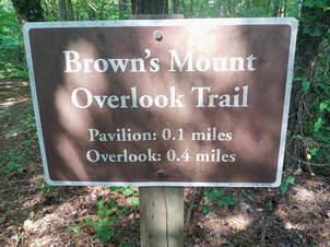
Please, collection by photography only, do not remove fossils or artifacts from Brown’s Mount! Hiking is encouraged, but explore with a light touch and collect nothing but images and memories, leave nothing but footprints.
Please, Collection by Photography Only!
Please, collection by photography only, do not remove fossils or artifacts from Brown’s Mount! Hiking is encouraged, but explore with a light touch and collect nothing but images and memories, leave nothing but footprints.
Were Sea Levels Really So High?
Do these sand dollar tell us that sea levels were 550 feet above current coastlines 34 million years ago? No, not necessarily. Sea levels were certainly much higher, but not 500-plus feet higher.
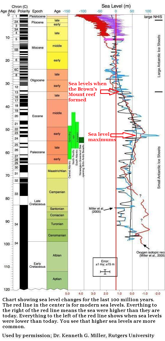
Research which we'll look at momerntarily shows that known sea level maximums reached about 430 feet above modern levels 21 million years before this limestone reef formed. That's 100 feet lower than needed to submerge the summit of Brown's Mount.
When the reef formed sea levels were roughly 165 feet above modern levels. So clearly, there’s more to this story than meets the eye.
|
Silica
Silica is most commonly found in nature as quartz. But for our purposes here we're looking at it as a mineral suspended in groundwater. If silica-rich groundwater fills a cavity deep in a mountain where there's heat generated by immense pressure, a quartz crystal will percipitate out. But what happens to silica-rich groundwater in a limestine aquifer? Our silicified limestone reef stands high above Bibb County. To be silicified it had to be an aquifer at some point. This means that not only was this reef submerged beneath a warm sea 34 million years ago, but sometime after sea levels retreated it was buried by terrestrial sediments. When it was undergound, this limestone spent a period as an underground aquifer for silica rich water. Aquifers & Silicification Let me try to explain. Limestone is an important aquifer. |
When limestone is underground it can hold vast amounts of fresh water. Underground lakes and rivers are the aquifers which supply water to our homes, towns, and cities.
Much of the water on Georgia’s Coastal Plain comes from limestone aquifers. That white limescale on your showerhead came from your limestone aquifer, vinegar (an acid) will dissolve it and clean it away.
If the freshwater in the aquifer is mildly acidic (which is common), the limestone will slowly dissolve; that’s how caves and sink holes form. That’s why acidic vinegar cleans your showerhead.
However, if the water is silica-rich, then the limestone absorbs the silica and hardens it dramatically into silicified limestone, also known as chert. One of the technical terms for this is cryptocrystalline quartz. That includes chert, flint, jasper, agates, silicified (& agatized) wood, chalcedony and a few others. It was the preferred material for points and tools among native Georgians.
Chert is often very hard, rugged, enduring, and it is completely immune to acid. Essentially, silica is the foundation of quartz. While there is indeed a great deal of silicified limestone on Georgia’s Coastal Plain none of it, except Brown's Mount, is 540 feet above sea level. Most silicified limestone is found at lower elevations or underground.
By way of comparison, the highest point in all of Florida is Britton Hill at 345 feet above sea level. It's in west Florida, just south of central Alabama.
So, the summit of Brown’s Mount was buried by later sediments and acted as an aquifer of silica-rich ground water. These sediments were later eroded away again exposing the encircling, and now silicified, limestone reef.
|
This tells us that not only have there been repeated, dramatic changes in sea levels, but there has also been large scale erosion on our Coastal Plain, and on the Piedmont, for that matter.
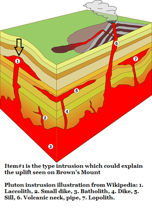
This isn’t a surprise. There's ample evidence all over the Coastal Plain that sea levels have dramatically advanced and retreated dozens of times since those sand dollars lived on the summit of Brown’s Mount. There’s also ample evidence of large-scale erosion, but when these erosional events happened is less clearly understood. Elevation But why is the reef on Brown’s Mount so much higher than any of the many other limestone beds on the Coastal Plain? The first suspect was a pluton. A pluton is an intrusion, deep underground, of igneous rock. Imagine magma pushing up and forming a lens while still deep underground, this lens could form a hill on the surface. |
Stone Mountain is a pluton which formed underground about 300 million years ago during the raising of the Appalachian Mountains. (See Section 5: Georgia Before Dinosaurs, of this website.) Erosion later exposed Stone Mountain. There are additional plutons in the Macon area, just at the surface, which are being mined for granite. However, these granite quarries formed at the same time as Stone Mountain, about 300 million years ago and they're far too old to have any connection to Brown's Mount.
|
My old friend, Dr. Burt Carter, Retired Professor of Paleontology at Georgia Southwestern in Americus, just shook his head when I proposed a pluton beneath Brown's Mount. He reminded me that there's no evidence of deep volcanic activity along Georgia's Fall Line on the timeline of Brown's Mount. The last volcanic activity known to occur anywhere near the Fall Line was the opening of the Atlantic Ocean roughly 200 million years ago. (See Section 6A: Birth of the Atlantic Ocean of this website.) Burt went on to suggest isostasy as the explanation. |
Isostasy
So what is isostasy?
The online encyclopedia Britannica offers an excellent description and illustration of isostasy;
Isostasy | Plate Tectonics, Earth’s Crust & Gravity | Britannica
Essentially; the Earth's crust is part of a somewhat flexible, relatively thin skin enclosing a globe of hot, plastic asthenosphere. Plastic as in somewhat mallable. Wikipedia describes the asthenosphere as "...almost solid, but a slight amount of melting (less than 0.1% of the rock) contributes to its mechanical weakness. More extensive decompression melting of the asthenosphere takes place where it wells upwards, and this is the most important source of magma on Earth."
Mountain ranges mark the thickest points of Earth's crust. Ocean floors mark the thinnest. Of course, even at it's thinnest the crust is 3 miles thick.
The weight of mountains depresses the crust and somewhat displaces and lifts the surrounding crust, imagine pressing your finger into the skin of a water balloon. The weight of water during high sea levels, and the weight of collected sediments can also depress the skin, but to a lesser degree than the concentration of mountains. As the mountain erodes from wind and rain, its weight is dispersed and the crust rebounds.
Of course, this is further complicated by the shifting weight of advancing and retreating sea levels and the fact that Brown's Mount is so close to the Fall Line and then dense, thick, rigid bedrock isn't far below.
The Fall Line
It's important to remember that the Fall Line is a line of relatively soft sediments lying on top of much older, usually hard bedrock. In Georgia it stretches from Augusta, through Macon to Columbus. These are locations where you encounter falls or shoals on our major rivers, rivers which once knew considerable freight traffic. These cities were originally built as inland river ports for barges and riverboats to load and unload passengers and cargo.
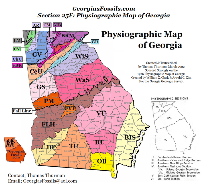
Geologically speaking, the Fall Line itself is a blanket of sediments. In the Macon area, just north of Brown's Mount, that blanket might be scant inches to a few feet thick until you reach the Fall Line Hill District (See Section 25F: Physiographic Map of Georgia, see FLH on the map below). As you progress south these sediments thicken dramatically.
|
In Tifton Georgia, 60 miles north of the Florida line, the sediments are 5,000ft (1,525 meters) thick and rest heavily atop extinct volcanoes. (See Section 5: Georgia Before Dinosaurs of this website). Today, those extinct volcanoes are 4,600 feet (1400 meters) below sea level.
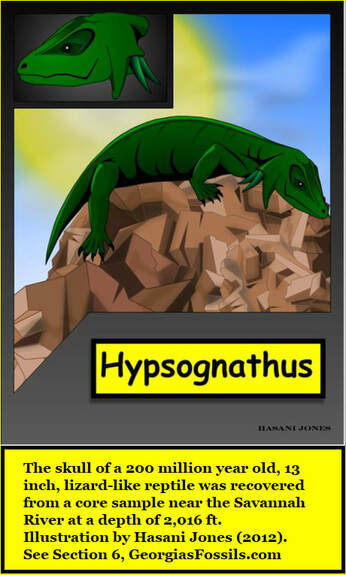
The power of sediments to depress terrain can also be seen on the presence of a 200 million year old reptile fossil, Hypsognathus, at a depth of 2,016 feet from a core sample taken in South Carolina near the Savannah River. (See Section 6: Georgia & South Carolina, 200 Million Years Ago) Of course, Hypsognathus lived on the surface during the time rift valleys were opening in Georgia. The reptile was buried by sediments after death, sediment which continued to collect and depress the terrain. This is how isostasy reshapes terrain, Burt Carter reminds me that its like a lever, if one site is depressed, another is lifted. |
1911; The Geologic Review of Brown’s Mount
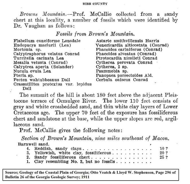
Interestingly, in 1911 a research team from the Georgia Geological Survey (GGS) and the US Geological Survey (USGS) looked at Brown’s Mount in passing for their report on Georgia’s Coastal Plain.
Otto Veatch and Lloyd Stephenson measured the peak at 180 feet above the Pleistocene sand beds along the Ocmulgee. They further reported that the lower 110 feet consisted of sands and clays probably dating to the Cretaceous Period (65+ million years ago or dinosaur times) while the upper 70 feet contained fossils in clay, sand, and chert from the Eocene Epoch (34+ million years ago). The publsihed a report of the fossils known to occur.
Native Georgians
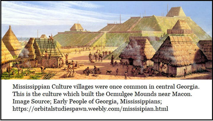
The Ocmulgee Archeological Society reports that the native Mississippian Culture used Brown’s Mount from roughly 900 to 1100 AD. But they also report evidence from Brown's Mount of both older and more recent native American presence. Below are the periods when Brown’s Mount is believed to have been occupied.
The Ocmulgee Archeological Society reports that the native Mississippian Culture used Brown’s Mount from roughly 900 to 1100 AD. But they also report evidence from Brown's Mount of both older and more recent native American presence. Below are the periods when Brown’s Mount is believed to have been occupied.
The below dates are highly flexible, cultures expanded and diversified in unpredictable and largely unknown patterns.
Period Approximate Age
Period Approximate Age
- Paleoindian Period 12,000 to 8,000 BC
- Archaic Period 8,000 to 3,000 BC
- Woodland Period 3,000 BC to 1,000 AD
- Mississippian Period 800 AD to 1600 AD
- Exploratory Period 1520 to 1670 AD
- Arrival of Europeans (Spanish) in the Florida.
- DeSoto did visit Brown’s Mount in the spring of 1540.
- Arrival of Europeans (Spanish) in the Florida.
- Historic Period 1670 AD to Present Day
|
There is so much we don’t know about Native American history, so much was shamefully destroyed by our ancestral European culture before it was fully understood or appreciated. Its doubly sad since pre-Columbian native American culture, in all its diversity, is the only world culture which rose, expanded, and diversified with little to no influence from Europe, Asia, or Oceania.
|
The Lost Wall of Brown’s Mount
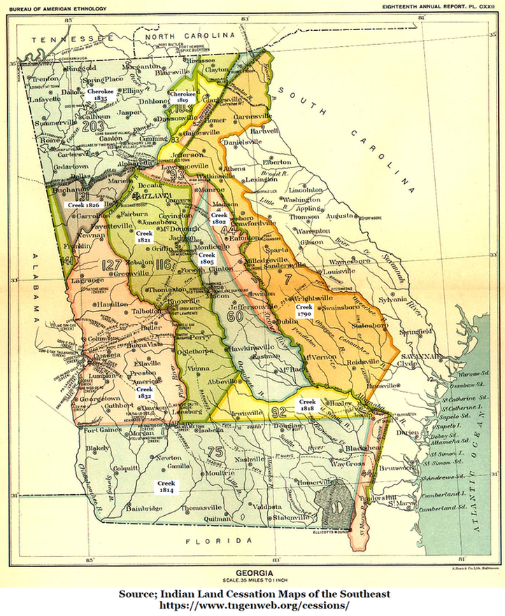
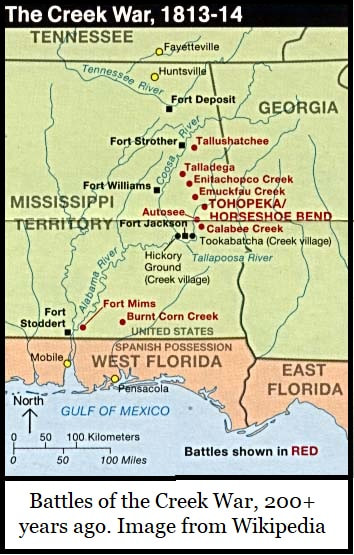
The strip of territory which includes Macon, Monticello, Jeffersonville, and Hawkinsville wasn’t ceded by the Muscogee Creek to the State of Georgia until 1805, that’s when Brown’s Mount became part of Georgia. The lands including Perry, Warner Robins, Thomaston, Atlanta & Vienna wasn’t ceded until 1821. Previously these territories were considered Indian Lands and blood was shed over them on both sides. The Creek War was fought in Alabama and Georgia from 1813 to 1814, many battles were fought in east Alabama.
The strip of territory which includes Macon, Monticello, Jeffersonville, and Hawkinsville wasn’t ceded by the Muscogee Creek to the State of Georgia until 1805, that’s when Brown’s Mount became part of Georgia. The lands including Perry, Warner Robins, Thomaston, Atlanta & Vienna wasn’t ceded until 1821. Previously these territories were considered Indian Lands and blood was shed over them on both sides. The Creek War was fought in Alabama and Georgia from 1813 to 1814, many battles were fought in east Alabama.
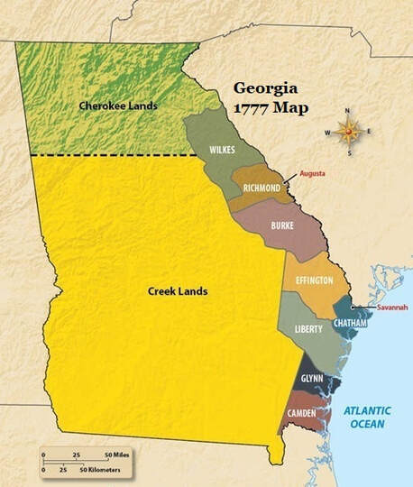
Georgia was one of the original 13 colonies, but in reality it was a much smaller Georgia which the European colonist controlled in the late 1700s. Most of what we know today as Georgia was Indian territory.
When Charles Lyell visited in the 1840s, he observed & reported a prehistoric wall which no longer exists. It’s suspected to be a Woodland Period construction, probably Mississippian.
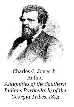
An excellent description of the wall was recorded by Charles C. Jones in 1873 in his book Antiquities of the Southern Indians Particularly of the Georgia Tribes. There, Jones states, “Brown’s Mount is situated on the line between Bibb and Twiggs Counties, from its summit it affords a fine view of the city of Macon, while, from its western exposure, which is very precipitous, the eye ranges all over the Ocmulgee Basin and across the country far away to the valley of the Flint River.”
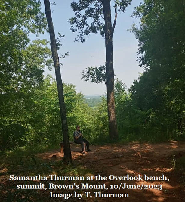
Today the hilltop is heavily forested with young growth trees and such views are severely limited. Native Georgians and early settlers kept the hilltop clear and maintained a clear view to watch the Ocmulgee River for trading and/or war parties. Trading between native villages was common and rivers were used for transportation.
Jones goes on to describe the old wall as “…Following the natural conformation of the summit boundaries, and at some points retired a distance of 20 yards from the edge of the hill, are the remains of an old wall – constructed of boulders of rock, and earth – which encircled and fortified the entire top of the mount. About 60 acres, I am informed, are thus enclosed.”
He further reported that traces remained of a ditch, both inside and outside the wall. Outside the wall the ditch was 10 feet wide and 4 feet deep. Inside the wall the ditch was 3 feet wide and 2 or 3 feet deep. Residents in 1873 remembered that the wall was 4 feet high and 4 to 5 feet wide within living memory. It was clear that between the ditch and the wall, defenders would be completely protected.
Jones continues his description. “Within the enclosure are the traces of two small earth-mounds, and near the northeastern side is a pond or basin, elliptical in form, covering about a quarter of an acre.” He reports that defensive abilities of the wall was enhanced by platforms and lunettes (crescent moon shaped defensive earthworks) set at 30 yard intervals and gives dimensions for the lunettes as 10ft by 8ft.
Jones continues his description. “Within the enclosure are the traces of two small earth-mounds, and near the northeastern side is a pond or basin, elliptical in form, covering about a quarter of an acre.” He reports that defensive abilities of the wall was enhanced by platforms and lunettes (crescent moon shaped defensive earthworks) set at 30 yard intervals and gives dimensions for the lunettes as 10ft by 8ft.
“In some places the wall has become well-nigh obliterated;” Jones stated in 1873, “at other points it is still quite distinct, and its entire circuit…can be traced along the crest of the hill.” Jones continues… “This was, without doubt, the work of red-men, and in ancient times constituted a fortified retreat. Similar structures exist within the limits of Georgia.”
Some have attributed this wall to DeSoto, he and his murderous expedition were indeed in the Ocmulgee River & Macon area in the spring of 1540 and reportedly visited Brown’s Mount, but even in 1873 Jones was adamant; “The impression, entertained by some, that this circumvallation was the work of De Soto and his followers, is erroneous.”
Some have attributed this wall to DeSoto, he and his murderous expedition were indeed in the Ocmulgee River & Macon area in the spring of 1540 and reportedly visited Brown’s Mount, but even in 1873 Jones was adamant; “The impression, entertained by some, that this circumvallation was the work of De Soto and his followers, is erroneous.”
Jones’ position that this is a pre-Columbian (pre-DeSoto) native structure is probably correct. He dated it to the Woodland Period, probably Mississippian. Today this is considered the South Appalachian Mississippian Culture. Wikipedia states “Typical settlements were located on riverine floodplains and included villages with defensive palisades enclosing platform mounds and residential areas.”
Jones additionally described a “…circular depression, about 40ft in diameter…” which he interpreted as evidence of a granary, a storage area for corn and other crops. He stated, “…the summit of this hill is well adapted to cultivation…” and believe the granary supported this.
Jones additionally described a “…circular depression, about 40ft in diameter…” which he interpreted as evidence of a granary, a storage area for corn and other crops. He stated, “…the summit of this hill is well adapted to cultivation…” and believe the granary supported this.
|
Zachary DiBois, a member of our Georgia’s Fossils Group on Facebook, sent me a report from 1989 stating that one of the mounds was a collapsed, circular earth lodge, similar to the one which has been re-construction at Ocmulgee National Monument. He attributed this to Ocmulgee Archeology: A Chronology by John W. Walker, 1989. This is a report I’m not familiar with but would likely be worth reviewing.
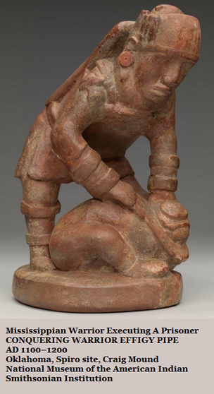
Defensive, hilltop stone walls are expensive to build and maintain, so they’re only constructed by a resident population fearing attacks. The Mississippian Culture was a farming culture maintaining fields of corn, beans, squash, sunflowers, and other crops and they tended to farm on river plains. They were also a war-like people and at least some northern tribes of North America practiced human sacrifice. A famous pipe from Ohio shows a warrior executing a bound prisoner. |
|
Mississippian burial Mound 72 at Cahokia Mounds State Historic Site in Illinois was found with the remains of a high-ranking male (assumed chief) and 250 other skeletons inside. Researchers believe that 61% of these were sacrifice victims. There were 4 young males missing their hands and skulls. There were more than 50 young women, all around 21 years, seemingly sacrificed and buried in two layers separated by matting. Below this was a layer of 40 men and women with some violently killed and some clearly buried alive.
The relationships of these people isn’t clear but there is ample evidence that this mound was built over a period of several years and all of these sacrifices were not made at the same time. After the Mississippians, other tribes and cultures populated this area, including the Muscogee (Creek) people. |
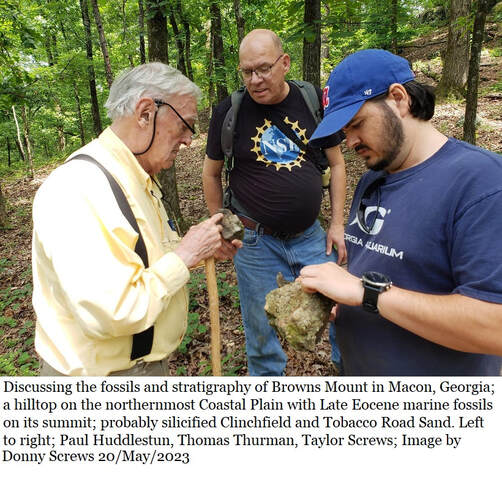
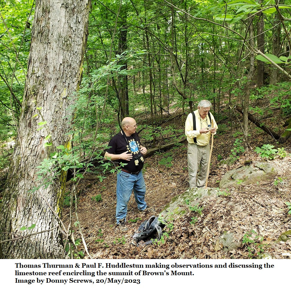
On a recent visit to the mount with Paul Huddlestun, Donny Screws and Taylor Screws (02/May/2023) we saw largish dornicks of a fossil dense chert which matched the Early Oligocene Chert of Houston County 20 miles to the south, these were just off the summit, above and behind the current overlook bench. In the Houston County area, this was the material used by natives to knap their tools, but this particular material was too fossil rich to be useful in knapping. So does this chert also occur naturally on Brown’s Mount? That’s not impossible, but we also know that natives traded extensively. So many questions, so few answers.
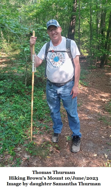
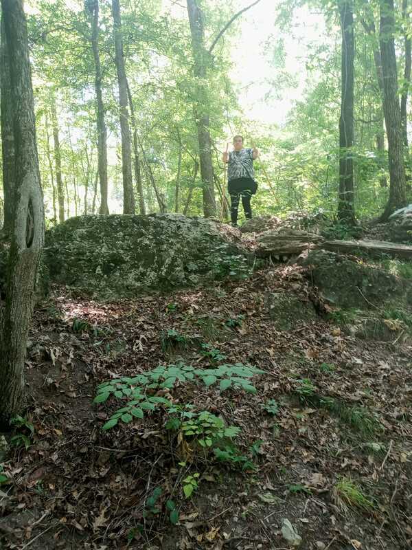
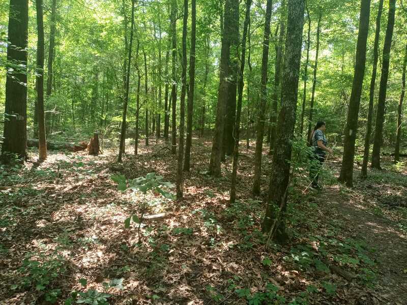
I looked at this material again during a 10/June/2023 hike with my youngest daughter Samantha. We were onsite looking for any evidence of the lost wall described by Jones in 1873. I’m hardly an expert on the mount’s archeology, and while I saw earthworks, it had the look of modern machine work, road or path building. I saw nothing I could confidently assign to the remnants of an ancinet stone and earth wall.
I looked at this material again during a 10/June/2023 hike with my youngest daughter Samantha. We were onsite looking for any evidence of the lost wall described by Jones in 1873. I’m hardly an expert on the mount’s archeology, and while I saw earthworks, it had the look of modern machine work, road or path building. I saw nothing I could confidently assign to the remnants of an ancinet stone and earth wall.
The Mid 1800s & The Muscogee Creek Wars
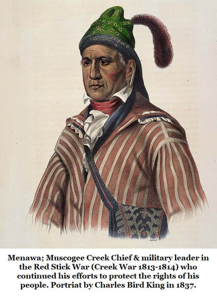
The Mississippians were waning when DeSoto arrived in 1540. By the time Europeans came in numbers the southeastern people of the Mississippian culture had evolved into the Muscogee Creek Confederacy in South Georgia while the Cherokee tribes populated lands in the north of the state. The Muscogee Creek Confederacy consisted of the Yuchi, Koasati, Alabama, Coosa, Tuskegee, Coweta, Cusseta, Chehaw (Chiaha), Hitchiti, Tuckabatchee, Oakfuskee tribe, and many others (Wikipedia). Many of those names have been preserved in Southeastern places names until their origin has been nearly forgotten.
In the early-1800s Nancy Moon and Daniel Rogers lived in a cabin on Brown's Mount and raised 4 children. Both were from Twiggs County families; Nancy Moon’s father was apparently a native (Muscogee Creek?) named Pleasant Moon who married Elizabeth Young. We know today that their daughter, Nancy Moon (Rogers) was born in 1832.
However, as late as 1830s there were still battles in the Southeast between Europeans and native Americans. The first Creek War had been settled in 1814 when Andrew Jackson forced the terms of the Treaty of Fort Jackson and the Creeks surrendered a large swath of South Georgia along with Central and Eastern Alabama to the US Government.
The Second Creek War (Creek War of 1836) was fought in Alabama. According to Wikipedia, the Muscogee Creek were forced from Georgia in 1826 under the Treaty of Washington. In Alabama there were still about 20,000 Muscogee, but Alabama acted to abolish tribal governments and extend state laws over the tribes.
The Treaty of Cusseta in 1832 divided up Muscogee lands into individual allotments.
Tribal members could either sell their allotment and remove to Indian Territory across the Mississippi River or stay on their land and live under state and federal laws.
European squatters and land speculators began defrauding Creeks out of their land allotments, violent backlash ensued. A band of about 400 Creeks responded by burning local homes and plantations along the Pea River swamp as they moved south. Even the Three Notch Trail that traversed through Troy, Alabama was considered dangerous at this point, as other local Creek Indians around the area were turning violent and burning and looting houses along the stretch of road.
European squatters and land speculators began defrauding Creeks out of their land allotments, violent backlash ensued. A band of about 400 Creeks responded by burning local homes and plantations along the Pea River swamp as they moved south. Even the Three Notch Trail that traversed through Troy, Alabama was considered dangerous at this point, as other local Creek Indians around the area were turning violent and burning and looting houses along the stretch of road.
|
Federal officials described the violence as a war in order to dismiss prior treaty rights. The US Secretary of War dispatched General Winfield Scott to end the violence and forcibly remove the Creeks from Alabama to Indian Territory west of the Mississippi River.
On 27/Mar/1837 the Battle of Pea River was fought 17 miles east of Troy, Alabama. 250 members of the combined Georgia & Alabama state militia found a temporary Muscogee Creek camp of about 400 men, women and children in a swamp and attacked. Wikipedia reports that the Creek men, women, and children fought back. “A fierce four-hour battle ensued.” In the end 50 Muscogee men, women and children were killed, and an unknown number taken as prisoners with some, apparently, sold into slavery among local planters. Five members of the state militias died in the fight. |
The infamous Trail of Tears was a tragic ethnic cleansing and forced displacement between 1830 and 1850 of approximately 60,000 Americans of the Muscogee Creek, Cherokee, Seminole, Chickasaw, and Choctaw Tribes from their ancestral lands to Indian Territory west of the Mississippi River as part of the Indian Removal Act of 1830 (US Congress).
Estimated fatalities from the Trail of Tears range from 4,000 to 15,000.
Estimated fatalities from the Trail of Tears range from 4,000 to 15,000.
|
According to a family Bible, Pleasant Moon died in October 1843, his wife Elizabeth Young had passed a month earlier. They were both in their early 40s. Their child Nancy Moon (half Muscogee Creek?) grew up and married Daniel Rogers, together they raised 4 children on Brown’s Mount while the Creek Wars were waged in the Southeast.
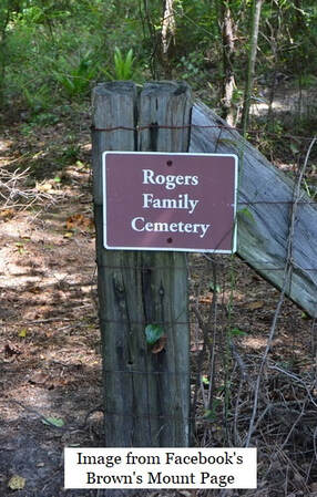
The Rogers Family Cemetery is located on Brown’s Mount near the Bibb - Twiggs County line. There are four unmarked adult graves and one unmarked youth grave beside the graves of Daniel & Nancy (Moon) Rogers. I don’t know if Nancey (Moon) Rogers was the last Muscogee Creek, the last American Indian, to live on Brown’s Mount. |
Brown’s Mount Sold to the State of Georgia
Several families lived on Brown's Mount through the 20th century until much of it was sold to the Museum of Arts and Sciences in Macon in 1993 and finally purchased by the State of Georgia in 2000. However, parts of the area are still under private ownership.
While this history is indeed fascinating, it clearly illustrates one of the problems with observing Brown’s Mount fossils, so much material has been moved around by humans over thousands of years, that it’s difficult to know what rocks are still in their natural location. But there’s no doubting that the silicified limestone reef crowning the hill is natural. The limestone is bedded, meaning it’s part of the hilltop.
Proposed Stratigraphy of Brown’s Mount
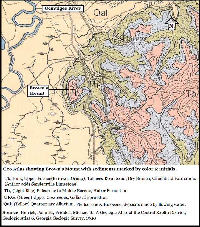
In 1990 John Hetrick and Mike Friddell published their geologic atlas of the kaolin district which included southeast Bibb County and Brown’s Mount though they don’t specifically mention it. They mapped the summit as Upper Eocene. They mapped Paleocene deposits beneath the summit and Cretaceous deposits, as the Gaillard Formation, at the mound’s base. The surrounding creek, swamp, and river floodplain are mapped as Quaternary (Pleistocene & Holocene) sands and clays.
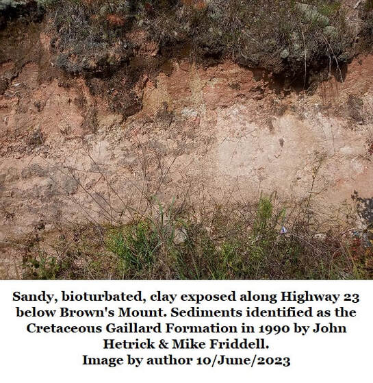
There’s a road cut along Hwy 23 just half a mile northeast of the summit which shows Cretaceous sandy clay matching the Gaillard Formation as reported.
Except for rare glimpses of mottled clay, this author saw no real evidence of the Paleocene deposits but I accept Hetrick & Friddell’s observations.
Author’s Proposed Brown’s Mount Stratigraphy
Sandersville Limestone (silicified)
Latest Eocene, appo. 34 million years
Clinchfield Formation (silicified)
Late Eocene, appo. 35.5 million years
Huber Formation
Middle Eocene to Paleocene
45 million to 60 million years old.
Gaillard Formation
Late Cretaceous; appo. 84 million years
Quaternary Alluvium
Pleistocene & Holocene, surrounding river & creek flood plains
Modern times to 2 million years ago
Sandersville limestone (Latest Eocene)
Clearly, this hilltop reef puzzles me. The sandy, silicified limestone doesn’t really match any of the primary, named, Late Eocene limestones. But the presence of sand dollars from the genus Periarchus confirms that the limestone is Late Eocene. As mentioned, Periarchus is a Late Eocene index fossil. The Eocene ended 33.9 million years ago with a large-scale global cooling and extinction event. All members of the genus Periarchus met extinction at the end of the Eocene. So, the limestone reef formed before the extinction event.
On the hillside 25ft below the limestone reef, the fossil-dense Clinchfield Formation is confidently recognizable as loose large dornicks or small boulders. It carries far too many fossils to be used in tool making, so it is probably natural here.
The reef must be younger than the Clinchfield Formation beneath it. The Clinchfield Formation dates to 35.5 million years old. The Eocene ended 33.9 million years ago. For more info on the Clinchfield Formation see this website, Section 14B; Fossils, Impacts & Tektites, Dating the Clinchfield Formation
There are only a few named limestones which occur in the 1.6-million-year gap between the Clinchfield Formation and the extinction event ending the Eocene Epoch. Only one of these, the Sandersville Limestone, is known to contain a significant amount of sand in a few exposures.
There are only a few named limestones which occur in the 1.6-million-year gap between the Clinchfield Formation and the extinction event ending the Eocene Epoch. Only one of these, the Sandersville Limestone, is known to contain a significant amount of sand in a few exposures.
So I suspect the silicified limestone reef encircling the summit of Brown’s Mount is a variant of the Sandersville Limestone. It is also known the host the sand dollar genus Periarchus, though in the Sandersville, Georgia area (45.5 miles to the east-northeast) the species Periarchus quinquefarius usually occurs. For more information see Section 14F; The Sandersville Limestone (by Hank Josey) of this website.
Paul Huddlestun, who wrote the official description of the Sandersville Limestone, may very well disagree with me on some of these points. That’s okay, I name Mr. Paul as a friend and recognize that he is much smarter than I about such things. I took him onsite for his first visit to Brown's Mount, Donny and Taylor Screws were with us.
Paul Huddlestun, who wrote the official description of the Sandersville Limestone, may very well disagree with me on some of these points. That’s okay, I name Mr. Paul as a friend and recognize that he is much smarter than I about such things. I took him onsite for his first visit to Brown's Mount, Donny and Taylor Screws were with us.
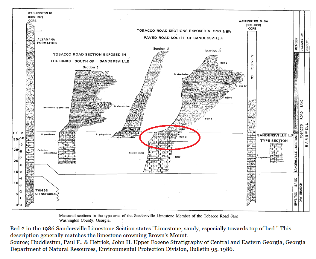
In 1986 Huddlestun and Hetrick described the Sandersville Limestone as a fairly pure limestone that is discontinuously sandy. It often has a “cottage cheese” appearance. It can be coarsely fossiliferous. They referred to it as the Sandersville Limestone Member of the Tobacco Road Sand. The section below was drawn by Huddlestun and shows the Tobacco Road Sand directly overlaying the Sandersville Limestone in a road cut south of Sandersville, Georgia. Where the two make contact the researchers report 4 feet of sandy limestone occurring.
|
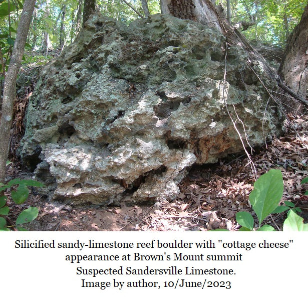
A sandy limestone describes the reef encircling the Brown’s Mount summit, as does a “cottage cheese” appearance, this reinforces the Sandersville Limestone diagnosis, but it could be an unrelated limestone both unnamed and distinct. Describing and naming new limestones is way beyond the scope of this amateur’s knowledge & capabilities, so the author will refer to the silicified limestone reef as the Sandersville Limestone until our level of knowledge improves.
The type locality for the Sandersville Limestone is a greenspace and creek exiting a cave 100 yards south of the end of Lime Street in Sandersville. According to Google Earth the limestone’s elevation here is about 430 feet above sea level. Clinchfield Formation (Early-Late Eocene) The Clinchfield is a nearshore, marine deposit showing a diverse, healthy, rich coastal environment. You can see matching, silicified, fossil-rich Clinchfield Formation sediments as loose boulders and bedded rock crowing Christy Hill, 5.5 miles to the northeast on the Bibb/Twiggs County line. |
It also occurs as a silicified, shelly-sand with dornicks 11.5 miles to the northeast of Brown’s ount in a road cut on the north side of Highway 57 in Twiggs County, near the Wilkinson County line.
In other locations east of Brown’s Mount, the Clinchfield Formation has proven to be Georgia’s richest, and most diverse source of vertebrate fossils. But no vertebrate material has been reported from Brown’s Mount, Christy Hill, or the Highway 57 outcrop.
In other locations east of Brown’s Mount, the Clinchfield Formation has proven to be Georgia’s richest, and most diverse source of vertebrate fossils. But no vertebrate material has been reported from Brown’s Mount, Christy Hill, or the Highway 57 outcrop.
Huber Formation (Paleocene to Late Cretaceous)
The Huber Formation is a sandy, kaolin bearing, pebbly clay often stained rust-red with oxidized iron. Trace fossils are known to occur. Further south and to the west, plant material as fragments, and in some locations lignified logs, are known to occur. See Section 9; Sassafras Hill Quarry of this website for more details. The Huber Formation is between 45 to 60 million years old. It is held to be a marine delta environment, where the paleo-Ocmulgee River mingled with the sea.
The Huber Formation is a sandy, kaolin bearing, pebbly clay often stained rust-red with oxidized iron. Trace fossils are known to occur. Further south and to the west, plant material as fragments, and in some locations lignified logs, are known to occur. See Section 9; Sassafras Hill Quarry of this website for more details. The Huber Formation is between 45 to 60 million years old. It is held to be a marine delta environment, where the paleo-Ocmulgee River mingled with the sea.
Gaillard Formation (Late Cretaceous)
An older kaolin deposit is seen on Hwy 23 along the access road the Brown’s Mount. The Gaillard formation is rich with sand and frequently stained with oxidized iron. Trace fossils as burrows and bioturbation occur in the road cuts on Hwy 23. Plant material is reported from the Gaillard but was not observed in Hwy 23 road cuts. It is also a coastal marine paleo-Ocmulgee River delta environment where the river me the sea.
An older kaolin deposit is seen on Hwy 23 along the access road the Brown’s Mount. The Gaillard formation is rich with sand and frequently stained with oxidized iron. Trace fossils as burrows and bioturbation occur in the road cuts on Hwy 23. Plant material is reported from the Gaillard but was not observed in Hwy 23 road cuts. It is also a coastal marine paleo-Ocmulgee River delta environment where the river me the sea.
Then there’s the issue of getting the limestone silicified, which means this 540ft hilltop was once an underground aquifer and the sediments which buried it at that time were, later-still, eroded away. Does this mean Brown’s Mount was once significantly taller? Again, not necessarily.
Thirty-four million years is time for a great deal of change. It’s possible that there’s an area along the Fall Line in Central Georgia which has experienced an uplift event in the last 34 million years which lifted Brown’s Mount 100 to 200 feet above the local terrain.
Thirty-four million years is time for a great deal of change. It’s possible that there’s an area along the Fall Line in Central Georgia which has experienced an uplift event in the last 34 million years which lifted Brown’s Mount 100 to 200 feet above the local terrain.
Go hike Brown’s Mount, wallow in the history, but go with a gentle hand collecting nothing but memories in great pics and leave nothing behind but footsteps. Seek ways we can not only preserve this site but share its history and expand the hands-on research. A measured section needs to be created of this silicified reef in the sky.
As an amatuer paleontologist and geologist, its always fascinating to follow in the footsteps of Sir Charles Lyell.
As an amatuer paleontologist and geologist, its always fascinating to follow in the footsteps of Sir Charles Lyell.
Links
Brown's Mount AssociationBrowns Mount Facebook Page
Brown's Mount AssociationBrowns Mount Facebook Page
- Brown Mount Facebook
References
- Veatch, Otto; Stephenson, Lloyd William; Preliminary Report on the Geology of the Coastal Plain of Georgia; US Geological Survey, Georgia Geological Survey, Bulletin 26, 1911
- Jones, Charles C. Jr; Antiquities of the Southern Indians Particularly of the Georgia Tribes, D. Appleton & Company, New York, 1873
- Hetrick; John H.; Geologic Atlas of the Fort Valley Area, Geologic Atlas 7, Georgia Geologic Survey, 1990
- Huddlestun, Paul F., & Hetrick, John H. Upper Eocene Stratigraphy of Central and Eastern Georgia, Georgia Department of Natural Resources, Environmental Protection Division, Bulletin 95. 1986.
- Herrick, S. M.; Age and Correlation of the Clinchfield Sand in Georgia. Contributions to Stratigraphy, Geological Survey Bulletin 1354-E, USGS 1972
- Hetrick, John H.; Friddell, Michael S.; A Geologic Atlas of the Central Kaolin District; Geologic Atlas 6, Georgia Geologic Survey, 1990
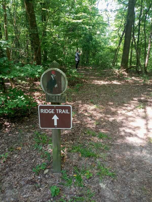
Below, images from a wonderful afternoon hike at Brown's Mount with my daughter, Samantha Thurman, 10/June/2023
