15A: The Marianna Limestone
Eastern Gulf Of Mexico Stratigraphic Association
Approximately 30 million years old.
Hawkinsville, Pulaski County, Georgia
Mile Creek Exposure
North 32°16.155'
West 083°27.626'
Elevation; 196ft
Our Marianna Limestone was named for matching sediments in Marianna, Jackson County, in western Florida.
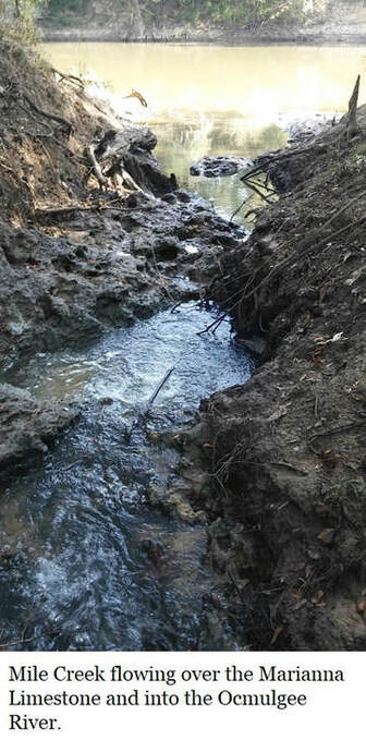
In Georgia, it is only observable just south of Hawkinsville and is most easily seen in the bed of Mile Creek where it joins the Ocmulgee River, approximately 200 yards downstream of the Hawkinsville boat ramp.
This is a gentle hike over a prepared trail. Only the climb down to the river bank presents any difficulty and even this is assisted by "root" steps and a railing.
This outcrop isn’t recorded in the literature. In 1993 the only outcrop of the Marianna Limestone which Huddlestun was aware of were bluffs along the Ocmulgee River where the Marianna Limestone is overlain by the Glendon Limestone.
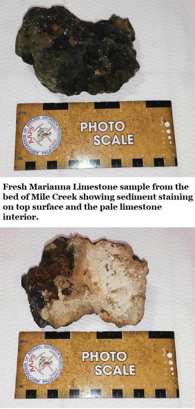
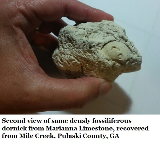
The creek-bed limestone is usually stained with creek sediments which aren't easily removed.
From the mouth of the creek the limestone continues to occur upstream in the winding creek bed for several dozen meters.
At Mile Creek the Marianna Limestone is overlain by a fine, loose quartz sandy soil with a very minor clay content. In the creek small, rounded quartz pebbles were observed in sparse quantities.
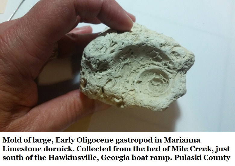
Collected samples from the creek bed show abundant Lepidocyclina mantelli forams often stacked like pancakes, bryozoans, random echinoid spines & fragmentary shells.
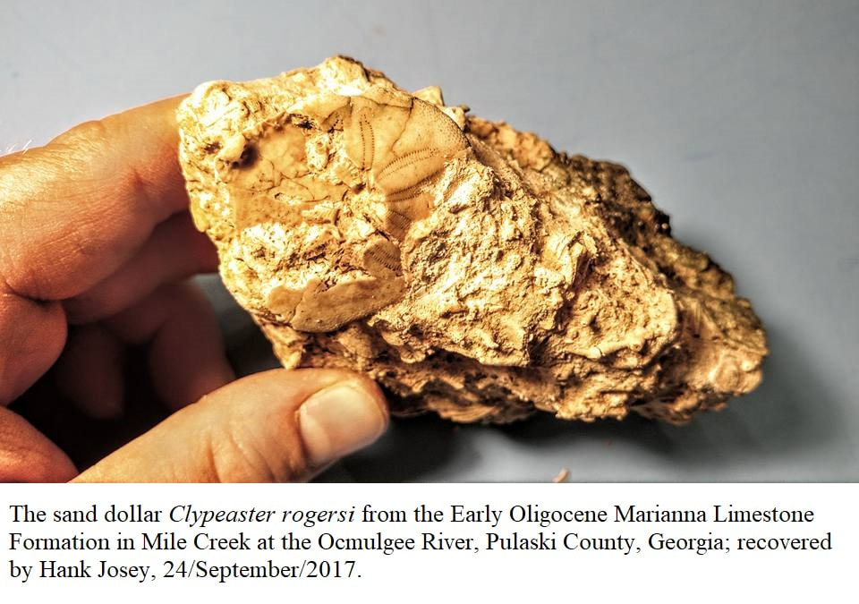
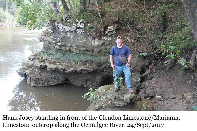
Hank Josey recovered a complete, if somewhat crushed, Clypeaster rogersi, (image) from this location on 24/Sept/2017.
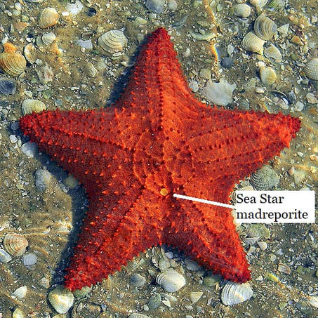
Some years ago I (Thurman) recovered the madreporite of a sea star. A madreporite is the “stone” on the top of a sea star; it’s a calcareous (made of calcium) filter where water is drawn into the vascular system. Sadly, madreporites aren’t useful for identifying species but the only part of a sea star which frequently fossilizes.
Hank Josey recovered a complete, if somewhat crushed, Clypeaster rogersi, (image) from this location on 24/Sept/2017.
Some years ago I (Thurman) recovered the madreporite of a sea star. A madreporite is the “stone” on the top of a sea star; it’s a calcareous (made of calcium) filter where water is drawn into the vascular system. Sadly, madreporites aren’t useful for identifying species but the only part of a sea star which frequently fossilizes.
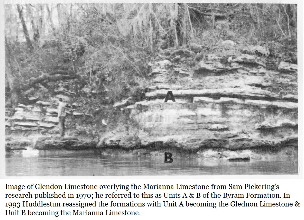
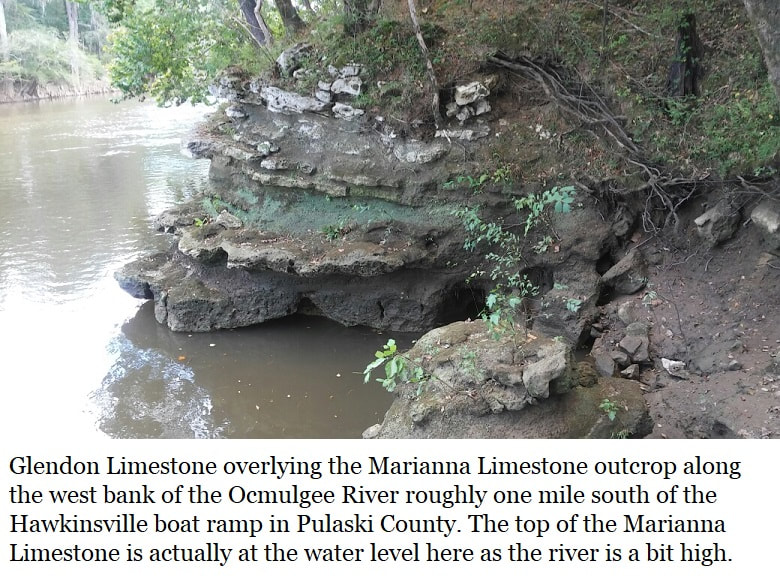
Georgia’s reference locality for the Marianna Limestone is along the Ocmulgee River, about .75 miles further downstream from Mile Creek. There a bluff stands along the western riverbank with the Glendon Limestone (which we’ll look at momentarily) overlying the Marianna Limestone. In 1970 Sam Pickering referred to this whole bluff as the Byram Formation with the Glendon Limestone as Unit-A and the underlying Marianna as the Unit-B of the Byram formation.
Species recorded Marianna Limestone in Georgia
(These are index fossils which confirm the limestone’s age.)
Echinoids
Clypeaster rogersi
Paraster americanus
Foraminifera
Lepidocyclina mantelli
Note: In 1970 Pickering reported 77 species of foraminifera from the Byram Formation which he divided into Units A & B, but Pickering didn’t differentiate which unit produced which fossils. In 1993 Huddlestun separated the two formations; Unit A was assigned as the Glendon Limestone & Unit 2 assigned as the Marianna Limestone.
As the images show there are clearly more fossils in the Marianna Limestone which need to be identified & listed.
The Marianna Limestone reference locality in Georgia rest beneath the Glendon limestone for a thickness of a few feet depending on river level. It only occurs in one core sample from Pulaski County (GGS-3111) and is 21 feet thick, occurring between 75 & 96 feet subsurface. The Glendon is absent at the core sample as it is at Mile Creek. No precise location is given for the core sample but it seems to be very near Hawkinsville.
In 1970 Pickering described the Marianna Limestone as “white to pale cream”, 98.41% pure calcium carbonate, plastic, soft chalk with isolated fossils. Pickering described the sediments as possessing abundant small foraminifera. He noted the “coin-shaped large foraminifera Lepidocyclina mantelli, occurs most abundantly in a bed three feet thick in which it is scattered helter-skelter at all orientations but the fragile test is generally unbroken.”
Pickering’s 1970 text goes on to observe; “It is not known whether the random orientation of the tests of Lepidocyclina mantelli represents their mode of life in the bottom sediment or whether they were carried in by a gentle bottom current which did not fragment them. As the bed of concentration of these larger foraminifera is remarkably continuous over 200 yards distance the former hypothesis seems more tenable.”
It is noteworthy that the Marianna Limestone isn’t silicified, as are the majority of Oligocene deposits northwards on the upper Coastal Plain. Huddlestun observed; “The Marianna Limestone in Georgia was deposited on the inner continental shelf in an area devoid of siliciclastic sediments. It appears to grade landward into siliciclastic-rich (silica & clay rich), coastal deposits, and it appears to grade seaward into more open marine Bridgeboro Limestone.
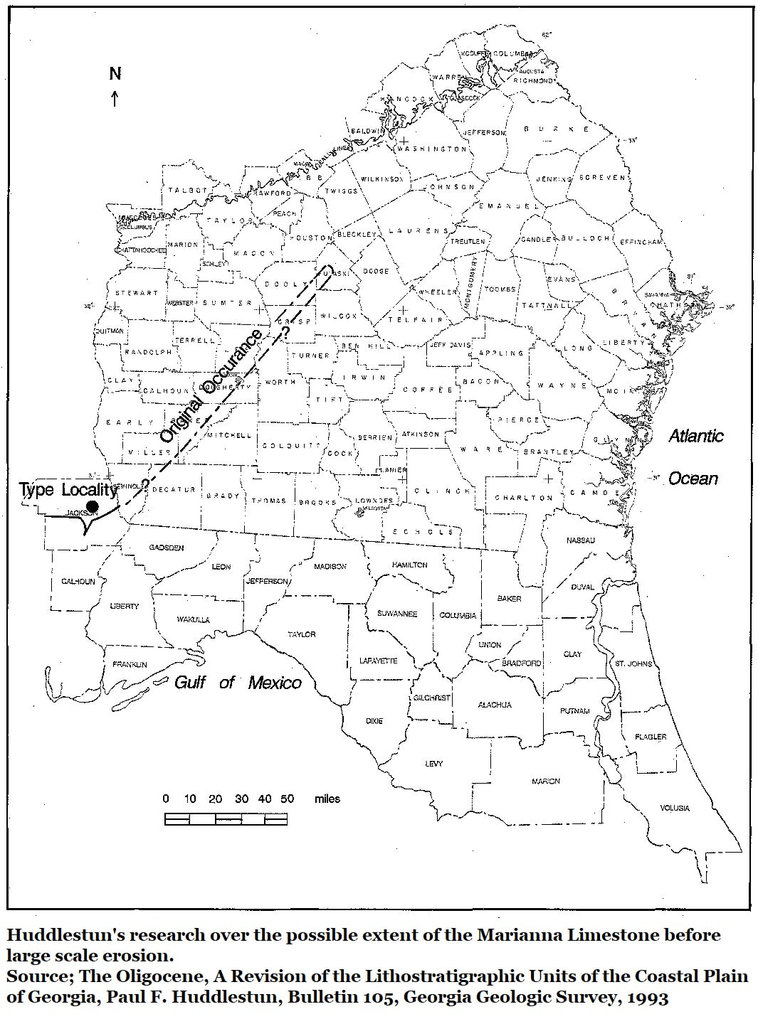
Huddlestun observed that there are also no additional reported occurrences of the Marianna Limestone between the three known Hawkinsville locations (two outcrops & one subsurface) and the Jackson County, Florida location. His extensive field knowledge led him to the conclusion that while the limestone had once likely been continuous between Jackson County, Florida and Pulaski County, Georgia and crossed southwest Georgia's Dougherty Plain, a distance of 150 linear miles, all Oligocene sediments once occupying the Dougherty Plain had been either eroded or weathered to residuum.
Huddlestun further commented; “It is possible that the Marianna Limestone once formed a continuous outcrop belt from Jackson County, Florida, at least as far northeast as the Ocmulgee River area. The Marianna Limestone in Pulaski County would represent an outlier or remnant of the once-continuous formation.”
All that remains readily accessible in Georgia today is the deposit in the creekbed of Mile Creek, as access to the Ocmulgee River outcrop is dependent on river levels.
References;
The Oligocene, A Revision of the Lithostratigraphic Units of the Coastal Plain of Georgia; Paul F. Huddlestun, Bulletin 105, Georgia Geologic Survey, 1993
Stratigraphic, Paleontology, and Economic Geology of Portions of Perry and Cochran Quadrangles, Georgia; Sam M. Pickering, Bulletin 81, Georgia Geologic Survey, 1970