28C: Coastal Plain
Core Logs
by
Paul F. Huddlestun
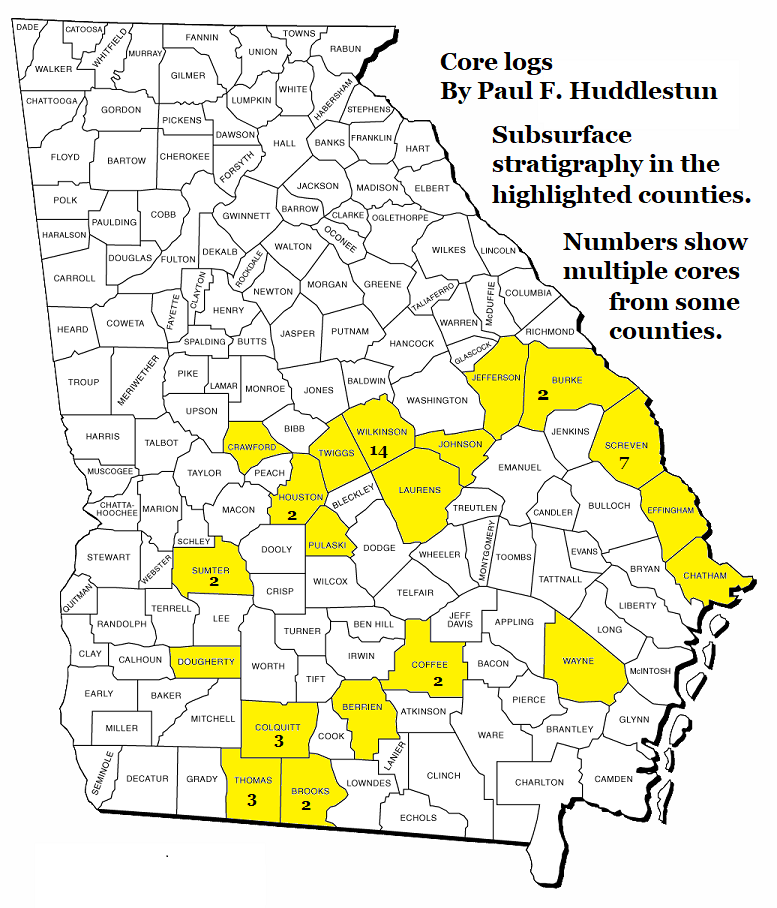
The below logs were created by Paul F. Huddlestun and he has agreed to make them available here for free download to all researchers and amateurs interested in Georgia paleontology.
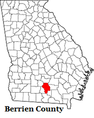
Berrien County
BERRIEN 10
ENIGMA CORE, GGS 3542, (KING FARM)
BERRIEN COUNTY, GEORGIA
Enigma 7½’ Quadrangle
GULF TROUGH
Latitude 31° 25.653’
Longitude 83° 17.936’
Elevation 325 Feet
Core depth 1271 Feet
Core; Paul Huddlestun
Logged ca. 1989
Finished writing up – 1/6/13
1.2 miles northeast of the community of Enigma in Berrien County, on Luke-King Road, adjacent to pond, 0.2 miles north of junction with A T Fuller Road.
| berrien_10__enigma_.doc | |
| File Size: | 157 kb |
| File Type: | doc |
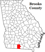
Brooks County
BROOKS 7A, GGS-3189, US GYPSUM 76-2a
BROOKS COUNTY, GEORGIA
1 mile south of Pavo, off of GA 33 (County Line Rd), near junctions of Green Rd & Tillman Rd
Latitude N 30° 56.441’
Longitude W 83° 44.088’
Elev. ~220 Feet
Core depth 335 ft
By; Paul Huddlestun, logged ca. 1977 & relogged - 8/22/11
BROOKS 7A, GGS-3189, US GYPSUM 76-2a
BROOKS COUNTY, GEORGIA
1 mile south of Pavo, off of GA 33 (County Line Rd), near junctions of Green Rd & Tillman Rd
Latitude N 30° 56.441’
Longitude W 83° 44.088’
Elev. ~220 Feet
Core depth 335 ft
By; Paul Huddlestun, logged ca. 1977 & relogged - 8/22/11
| broo0ks_7a__pavo_15sept.doc | |
| File Size: | 65 kb |
| File Type: | doc |
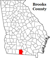
Brooks County
BROOKS 7B, GGS-3209, U.S. GYPSUM 76-2c
BROOKS COUNTY, GEORGIA
1 mile south of Pavo, off of GA 33 (County Line Rd),
near junctions of Green Rd and Tillman Rd
Latitude N 30° 56.641’
Longitude W 83° 44.211’
Elev. ~200 Feet
By; Paul Huddlestun
Written up in part – 11/10/11
Finished – 6/7/13
BROOKS 7B, GGS-3209, U.S. GYPSUM 76-2c
BROOKS COUNTY, GEORGIA
1 mile south of Pavo, off of GA 33 (County Line Rd),
near junctions of Green Rd and Tillman Rd
Latitude N 30° 56.641’
Longitude W 83° 44.211’
Elev. ~200 Feet
By; Paul Huddlestun
Written up in part – 11/10/11
Finished – 6/7/13
| brooks_7b__pavo__15_sept.doc | |
| File Size: | 111 kb |
| File Type: | doc |
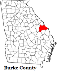
Burke County
BECHTEL CORE VG-6
BURKE COUNTY, GEORGIA
Millett 7½’ Quadrangle
At jct. of River Road and Brigham Landing Road, on top of hill,
approximately 3.0 miles north of Burke/Screven Counties line
in southern Burke County, GA
Latitude N33° 02.650’
Longitude W81° 37.029’
Elevation 217.1 Feet
Depth 620 Feet
Paul Huddlestun
Logged – 7/22/92
Written up – shortly thereafter
Core is stored at Plant Vogtle
| bechtel_vg-6.doc | |
| File Size: | 107 kb |
| File Type: | doc |
Burke County
USGS GIRARD CORE,
BURKE COUNTY, GEORGIA
Girard 7½’ Quadrangle
On Griffins Landing Road, adjacent to Lookout Tower, 0.75 miles north of jct. of Griffins landing Rd. and Ga. 23 (Millhaven Rd.), Approximately 1.75 miles NNW of Girard, Burke Co., GA
Latitude N 33° 03' 27" Elev. 250 Feet
Longitude W 81° 35' 23"
Elevation 250 Feet
Depth From 318' to 1,385'
Paul Huddlestun
Logged - Thanksgiving Holidays - 1989
Written up - 10/18/93
Edited – 5/16/10
Notes;
I didn’t bother to log the upper part of the core because that section is well represented by a number cores in Burke County.
In addition, I went over to Columbia, South Carolina, during the Thanksgiving Holidays in 1989 to log the core that bottomed in the Triassic and time was short; I had to finish by Sunday afternoon. So it was in the SCGS warehouse, where the USGS had temporarily stored the core, and on my own time for the Holidays. Glad there was a Waffle House next to the motel.
| girard_core__usgs__tt.doc | |
| File Size: | 201 kb |
| File Type: | doc |
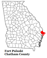
Chatham County
USGS COCKSPUR ISLAND CORE TT
COCKSPUR ISLAND, CHATHAM COUNTY, GEORGIA
Fort Pulaski 7½’ Quadrangle
Approximately 0.6 miles west of Fort Pulaski, beside an unnamed road on Cockspur Island in the Savannah River in Chatham County, Georgia
Latitude N 32° 01’ 33.67”
Longitude W 80° 54’ 06.94”
Elevation 8 Feet
Depth 1020 Feet
Paul Huddlestun
Logged – 3/5/10
Written up – 4/24/10
Note
"This log will anchor the deeper, seaward section. Later I’ll forward the best of the Tybee Island logs to anchor the shallow, seaward section."
Note at base of log...
"Top of Wilcox Group at 1094 feet and the presence of chert below 1094 feet as reported by Herrick (1961) in the nearby GGS-381."
"Herrick (1961), working with well cuttings, usually placed the top of the “Tallahatta” at the top of the first greensand (glauconitite) bed working down-section from what he considered to be Claibornian. Based on my experience, I do not know if the top of the first greensand bed wanders up and down or if it defines a useful, mappable horizon. However, in the subsurface of most of south Georgia, one does encounter greensand sequences below what is definitely upper Middle Eocene, Claibornian limestone. Lithologically, it appears that the section above the greensand beds, in the Cockspur Island core, appears to be one continuous formation although I have noted that below the definitely upper Claibornian, the limestone becomes progressively finer and finer grained down-section, becoming very chalky, pasty and dense. USGS people consider the entire section below the Ocala in the Cockspur core to be upper Claibornian, Lisbon equivalent. I have no opinion!"
| cockspur_island_core.doc | |
| File Size: | 180 kb |
| File Type: | doc |
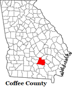
Coffee County
Coffee 3; COFFEE COUNTY, GEORGIA
GGS 3539, THURMAN FARM 1, Broxton North 7½’ quadrangle
Latitude N 31° 42.788’
Longitude W 82° 54.164’
Elevation 290 Feet
Core Depth 267 Feet
Core; Paul Huddlestun
Logged – ca. 1989
Completed writing up - 1/20/13
Gulf Trough; Near the composite site of the test wells GGS 468 and GGS 509 of Applin and Applin (1964, GGS Bull. 74)
Here are the Coffee 3 and 4 core logs. This is an important core site because it is a significant site of Applin and Applin (1964, GGS Bull 74). Not only does their well logs go through the Cretaceous but the site, unbeknown to the Applins, was in the Gulf Trough.
It is very important that the interested geologists/stratigraphers are acquainted with these core logs. I wish I had spent more time logging them back when; everything was such a hurry. Especially the limestone/dolostone descriptions. After them, I think I will forward the Savannah River logs from Burke County down to Chatham County and Tybee Island. Anyway, that’s the plan! The next log I send will be the Enigma core; named after the community of Enigma in Berrien County, not for the contents of the core!
Paul F. Huddlestun PhD
02/April/ 2021
| coffee_3.doc | |
| File Size: | 59 kb |
| File Type: | doc |
Coffee County
Coffee 4; COFFEE COUNTY, GEORGIA
GGS 3541, THURMAN FARM 2, Broxton North 7½’ quadrangle
Latitude N 31° 42.788’
Longitude W 82° 54.164’
Elevation 290 Feet
Core Depth 1,062 Feet
Core; Paul Huddlestun
Logged – ca. 1989
Completed writing up - 1/20/13
Gulf Trough; Near the composite site of the test wells GGS 468 and GGS 509of Applin and Applin (1964, GGS Bull.74)
| coffee_4.doc | |
| File Size: | 133 kb |
| File Type: | doc |
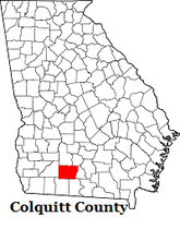
Colquitt County
COLQUITT 3
NORMAN PARK CORE, GGS-3179
COLQUITT COUNTY, GEORGIA
Norman Park 7½’ Quadrangle
Latitude N 31° 17.591’
Longitude W 83° 43.396’
Elevation 370 Feet
Core Depth 705 Feet
Core; Paul Huddlestun
Logged ca. 1978
Written up – 11/5/11
GULF TROUGH
2.8 miles northwest of the Norman Park in Colquitt County, on shoulder of Doe Run Norman Park Road, 0.1 miles south of junction with James Weaver Road
| colquitt_3__ggs-3179__norman_park_core__1_.doc | |
| File Size: | 103 kb |
| File Type: | doc |
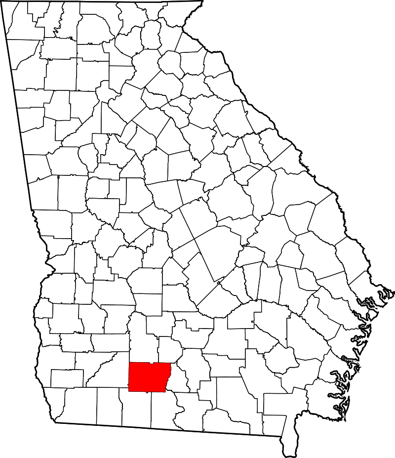
Colquitt County
COLQUITT 10 (CLARK FARM) GGS-3544 AND
COLQUITT 7 GGS-3213, SAME CORE SITE
COLQUITT COUNTY, GEORGIA
Immediately south of the southern rim of the Gulf Trough;
Roughly 2 miles southeast of Moultrie at jct. Tallokas Road and Old Berlin Road, to 0.5 miles southeast to jct. Tallokas Road and Old Berlin Road, to 0.3 miles southeast to jct. Old Berlin Road and Culbertson Road, to 0.3 miles northeast of Culbertson Road to Clark Farm, and 0.2 miles northwest of Culbertson Road at Clark Farm Berlin West 7½’ Quadrangle
Latitude N 31° 06.403'
Longitude W 83° 44.235'
Elev. ~270 Feet
By; Paul Huddlestun
Logged, 3/10/93
Redrawn: 5/31/09
Clay analyses by John Hetrick
Thomas:
These two lithologs are from the same site; the 10 is a GGS core that filled in the upper part of the U.S. Gypsum 7 core. U.S. Gypsum did a good job on the latitude, longitude and elevation of the core sites. The next core log I send will be from immediately northwest of Moultrie, right in the axis of the Gulf Trough. That will be another multicore site. Every stratigraphic unit below the Miocene is different. For the Miocene, the stratigraphic units within the trough are the same as those adjacent to the trough, but thicker.
Paul
| colquitt_10_-_colquitt__7__1_.docx | |
| File Size: | 58 kb |
| File Type: | docx |
Colquitt County
COLQUITT 11, GGS-3545, HARRELL FARM 1
DOE RUN CORE
COLQUITT COUNTY, GEORGIA
Doerun 7½’ quadrangle
Latitude N 31° 17.896'
Longitude W 83° 53.871'
Elevation 350 Feet
Depth 1,142 Feet
1.8 miles southeast of Doerun in northwestern Colquitt County, Georgia,
off of north side of Thaggard Road, 0.3 miles west of jct. of Ga 133 and Thaggard Road.
Core; Paul Huddlestun
Logged ca. 1988
Written up – 1/2/10
Here’s the Doerun log from the northwestern corner of Colquitt County. The location occurs along the line from Albany in the northwest, through Bridgeboro, and to Moultrie in the southeast; and ultimately southeastward to Ellaville on the Suwannee River in Florida, the type localities/area of the Suwannee and Ellaville Limestones and the Suwannacoochee Dolostone (the cross-section line is presented in the Oligocene bulletin). The Doerun core site is also on the northern flank of the Gulf Trough.
The geometry/ structural style of the Gulf Trough in the area appears to be a single normal fault in the basement, down on the northwest, possibly resulting from tension (Charlie Siever put a name on the fault put I don’t recall it right now). There doesn’t appear to be an associated normal fault to the northwest so it would be a one-sided graben with the northwest side dipping relatively steeply into the trough/graben.
Doerun is located on the northern side where the northeastern Gulf of Mexico, Coastal Plain strata are dipping into the deeper part of the Trough. That is, the normal suite of northeastern Coastal Plain stratigraphic units are located to the north of the Gulf Trough, and the suite of Florida platform stratigraphic units are present south and east of the Gulf Trough. As a result, the Marianna and Glendon Limestones are present in Pulaski County but not across the Gulf Trough in far southern Georgia or Florida. The Miocene Alum Bluff Group units are mostly present west of the Trough.
I’m forwarding the log right now because it contains the farther offshore, Paleogene units that can be matched to the eastern Georgia, Paleogene units in the Pineora and Davis-Hopkins cores. If more cores were to be taken south of the Gulf Trough in eastern and far southern Georgia, perhaps new stratigraphic units could be identified. Two core sites is not enough. Also, the Suwannee Channel is present in the subsurface in far southern Georgia. It’s the larger predecessor of the Gulf Trough and was active during the latest Cretaceous and earliest Paleocene, Midway. It underwent filling in the late Paleocene, Nanafalia/Tuscahoma depositional events and was completely filled in by the Late Eocene. I estimate that the Suwannee Channel is maybe 10 times the size of the Gulf Trough, a real biggee! The Davis-Hopkins core site is apparently on the top of the northern flank of the Suwannee Channel.
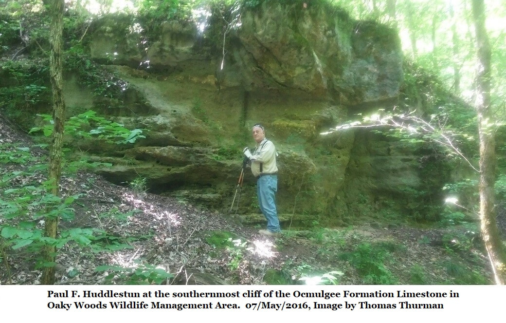
The next litholog will be the Arrowhead core. The site is near the northern-most extent of Pulaski County on the east side of the Ocmulgee River and in the Ocmulgee Wildlife Management Area between Hawkinsville and Oaky Woods. If I remember right I may have sent you the core log previously but I’m not clear on it. The core goes almost entirely through the Cretaceous but didn’t quite make it to basement. At any rate I’ll start cleaning it up this weekend.
Paul
| doerun_litholog_-_tt.docx | |
| File Size: | 53 kb |
| File Type: | docx |
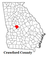
Crawford County
CRAWFORD 1A-1B (ZENITH CORE), GGS-3598
CRAWFORD COUNTY, GEORGIA
Fort Valley West 7½’ Quadrangle
1.5 miles southeast of the Gaillard-Allon sand pits, 0.5 miles west of Zenith, Crawford County, Georgia, on the side of Cummings Road, 0.15 mile south of the junction of Cummings Road and Zenith Mill Road
Latitude N 32° 36.55’
Longitude W 83° 59.0’
Elev. 600 Feet
Depth 331 Feet
Paul Huddlestun
Logged - 3/27/89
Written up – 3/20/14
This core is significant because the core site is a few miles south of the type locality and section of the Gaillard Formation. It is also noteworthy in that the Nakomis Formation is over 100 feet thick in the core but is absent in the Gaillard-Allon sand pits. However, such abrupt updip limits of various Cretaceous and younger formations seem to be common and not to be unexpected for formations in Georgia, especially in the northern part of the Coastal Plain. -Paul Huddlestun-
| crawford_1a-1b__zenith_core__ggs-3598.doc | |
| File Size: | 76 kb |
| File Type: | doc |
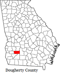
Dougherty County
USGS ALBANY CORE, GGS-3187
ARMY CORE OF ENGINEERS
DOUGHERTY COUNTY, GEORGIA
4 miles southeast of Albany, Georgia, 0.2 miles northeast of jct. US 19 (Liberty Expressway) and Honeysuckle Drive.
Latitude N 31° 31.127’
Longitude W 84° 06.795’
Elevation 195 Feet
Depth 1401.3 Feet
Paul Huddlestun
ca. 1975
Written log – 10-11/09 and 2/9/14
Email; 28/June/2021
Thomas:
Here, finally, is the Albany core log and an informal discussion of my present thoughts on the stratigraphic relationships of the various Late Eocene and earlier stratigraphic units. It would have to be tedious for readers to wade through but there is currently no other source of this stratigraphic information in the published literature and I felt that the readers of your website needed some kind of explanation for all this razzmatazz. What I have written below is only a first draft with two edits to try to eliminate as many of the bloopers as possible. If readers have trouble with the Oligocene, Miocene, and Pliocene, they can refer to published literature. If I were publishing this write-up, it would take another 7 or 8 drafts and I have no idea however much more time to wade through all of the literature and relationships between cores and outcrops. Read it over and see if you need any more information/corrections to understand what I’m trying to say.
Well, now I can get back to the Upper Eocene talk. And I can forward this on to you and not worry anymore about pressing a wrong key and permanently deleting the whole thing.
Paul
Please also see below; Huddlestun's Late/Middle Eocene Correlation Discussion as a separate file.
| albany_core_tt__ggs_3187__army_core_of_engineers__ace_.doc | |
| File Size: | 134 kb |
| File Type: | doc |
| huddlestun_explanation_late_eocene_and_earlier_stratigraphy_of_georgias_coastal_plain.docx | |
| File Size: | 65 kb |
| File Type: | docx |
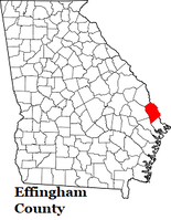
Effingham County
USGS PINEORA CORE EFFINGHAM COUNTY, GEORGIA
Guyton 7½’ Quadrangle
Latitude N 32° 17’ 45.38”
Longitude W 81° 23’ 50.34”
Elev. 70 ft
Core depth. 1,439 ft
Core; Paul Huddlestun
Logged upper part – 3/9-14/09
Logged lower part – 5/10
Written up – 7/12/10
Within the village limits of Pineora, Effingham County, Georgia, in a Roadside Side Park off of Honey Ridge Road, on the north side of Pineora
Note from Paul Huddlestun;
Two cores near the Atlantic coast, contain entire Tertiary stratigraphic sequences.
These are the Pineora core, taken in southern Effingham County, northwest of Savannah, and taken by the USGS, and the Davis-Hopkins core (see below), also taken by the USGS near the Altamaha River in Wayne County, Georgia, between Brunswick and Jesup. The upper part of the Tertiary sequences can be reliably subdivided lithostratigraphically into formal formations and members down to the upper Claibornian, Lisbon/Blue Bluff/Cooke Mountain-equivalents. Below this stratigraphic interval, the stratigraphic sequence has yet to be worked out in terms of lithologies and real stratigraphic position. An attempt to work out real stratigraphic interpretations was attempted by me with only partially good results. In the lower parts of the sections, only the lowest Paleocene, Clayton-equivalents is reasonably likely.
The lower Tertiary stratigraphic sequence does contain beds that appear to contain planktonic foraminifera and are also disaggregatable. The Pineora core was taken in 2010 and, unfortunately, I do not have a laboratory to process foraminifera in my home. On the other hand, the Davis-Hopkins core was taken in the late 1970’s when a laboratory was available. However, the lower Tertiary sequence is considerable deeper in the Davis-Hopkins core and recrystallization and consolidation of the sediments was more prevalent. As a result, only a few beds in the core proved to be disaggregatable. The planktonic foraminifera indicated roughly a late Paleocene, Nanafalia-equivalent age for the foraminifera; but the diversity of the suite was small due to preservation problems.
It is pointed out that the pre-Lisbon/Blue Bluff/Cooke Mountain-equivalent deposits, divided into “intervals” for the purpose of these litholog sections, are based both on lithostratigraphic evidence and on apparent disconformities, preferably with scoured surfaces, lag deposits, and hard-grounds. Although such “disconformities” are only apparent because such “disconformities” can also be found in shallow-water deposits within formations/depositional episodes where geologic time cannot be differentiated. To fully determine whether a “disconformity” is real, “missing time” must be established between the underlying deposit and the overlying deposit. This has yet to be done in the Pineora and Davis-Hopkins cores for the lower Tertiary. However, it is clear that, although there may be correlatable deposits between the known Eastern Gulf, Coastal Plain deposits and the Southern Atlantic, Coastal Plain deposits in Georgia, the formations/lithostratigraphic units themselves may be significantly different and require different lithostratigraphic names.
It does appear that in the Middle Eocene, Claibornian, there are more stratigraphic units present in the two down-dip cores than there are in the outcrop areas and shallow subsurface near the outcrop areas. These stratigraphic intervals may be correlatable with the Mississippi, Claibornian; where the pre-Cook Mountain, Middle Eocene is divided into the Tallahatta/Cane River, Winona, Zilpha, and Sparta sections. Similarly, the pre-Nanafalia, Paleocene has been subdivided in western, Alabama, from oldest to youngest, into the Clayton, Porters Creek, Naheola, and Coal Bluff Formations. Other than the Clayton and possibly Porters Creek, the other stratigraphic units are not present in the Georgia outcrop areas or shallow subsurface. They may be/appear to be, present in the farther offshore, subsurface.
| pineora_core__chatham_.doc | |
| File Size: | 239 kb |
| File Type: | doc |
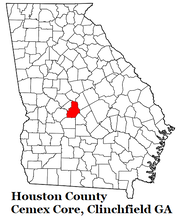
Houston County
CLINCHFIELD/MEDUSA LIME PIT
CEMEX
GGS-3058
HOUSTON COUNTY, GEORGIA
Approximately 0.75 mile southeast of jct. Keys Road and US 341 at Clinchfield, Houston County, Georgia, at the site of the Medusa lime pit, on the south side of Highway US 341
Latitude N 32° 24.100’
Longitude W 83° 37.988’
Elev. 382 Feet
Depth 345.0 Ft
Paul Huddlestun
Logged ca. 1973
Redrawn – 3/84
Written up – 6/6/14
| houston_4__ggs-3058__tt___medusa_lime_pit_.doc | |
| File Size: | 58 kb |
| File Type: | doc |
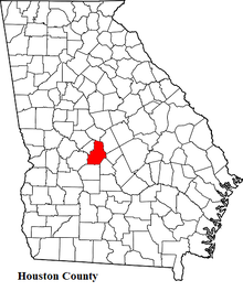
Houston County
HOUSTON 9 (ELBERTA CORE), GGS-3629
HOUSTON COUNTY, GEORGIA
(Northernmost Houston County)
Warner Robins NW 7½’ Quadrangle
Latitude N 32° 39.439’
Longitude W 83° 37.701’
Elev. 320 Feet
Core Depth 691ft
By; Paul Huddlestun
Logged - ca. 1989
Written up – 6/3/14
Core taken; In Elberta, on north side of Story Road, between jct. Long Street and jct. Gunsmoke Road; north side of Warner Robins
| houston_9__elberta_core__ggs-3629__1_.doc | |
| File Size: | 120 kb |
| File Type: | doc |
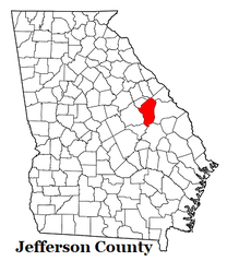
Jefferson County
WRENS CORE, GGS-3761
JEFFERSON COUNTY, GEORGIA
Matthews 7½’ quadrangle
Approximately 0.3 miles west of a cluster of abandoned kaolin pits, approximately 0.4 miles south of jct. GA 88 and an unimproved road, on the side of the unimproved road, 0.5 miles west of Brinson Crossing at jct. GA 88 and Quarter Road, approximately 1.5 miles east of the center of Wrens, Jefferson County, Georgia
Latitude N 33° 12.304’
Longitude W 82° 22.096’
Elev. 400 Feet
Depth 302 Feet
Paul Huddlestun
Logged and written up – 12/17/91
Edited and rewritten – 10/4/13
This core is significant because it indicates that, in the kaolin mining district of Georgia, the uppermost, Middle Eocene/Claibornian, hard kaolin being mined is not always the Jeffersonville Member of the formation but also may be an older representative/depositional event/stratigraphic interval of the formation. In the above Wrens core, it is suggested that the kaolin that had been mined nearby is Still Branch/lower Lisbon-equivalent. It is uncertain which upper Huber, stratigraphic interval is being mined between Wrens and Thomson, Georgia, to the north. It may well be Jeffersonville Member. -Paul Huddlestun-
| jefferson__wrens__tt_ggs-3761.doc | |
| File Size: | 82 kb |
| File Type: | doc |
Johnson County
USGS, WRIGHTSVILLE CORE
JOHNSON COUNTY, GEORGIA
On the south side of Hwy US 319, 0.8 miles west of Jct. of Hwys US 319 (W. Elm St.)/Ga 78 and Ga 15 (Marcus St.) in Wrightsville, north side of Johnson County Elementary School and Bell Pond
Latitude N 32° 43.644’
Longitude W 82° 43.980’
Elev. 354 ft
Depth 827 ft
By; Paul Huddlestun
March, 2011
Written up – 1/21/12
| wrightsville_core__usgs___2_.doc | |
| File Size: | 47 kb |
| File Type: | doc |
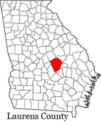
Laurens Core
LAURENS COUNTY (DUBLIN) CORE, GGS-3523, TT
LAURENS COUNTY, GEORGIA
Dudley 7½’ Quadrangle
In rest area 87 along east-bound lane of I-16,
2.6 miles southeast of Dudley, Laurens County
Latitude N 32° 30.491’
Longitude W 83° 02.768’
Elev. 285 feet
Depth 1690 feet
Core; Paul Huddlestun
ca. 1980
Written up – 2/19/14
Comments;
The main interest in the Arrowhead and Laurens County lithologs to me is that the cores were taken in the broad area of facies changes from fluvial environments (and therefore lithologies, Oconee Group) to coastal marine and shallow, shelf bottom lithologies. I think this is significant because this lithofacies change occurs broadly from the Middle Eocene down to the basal Coastal Plain Cretaceous deposits. The only way I can account for this is that there likely is (are) down-to-basin normal faults in the basement that are sporadically reactivated. The base of the local Cretaceous (~90 to ~100 ma) to the Middle Eocene (~40 ma) is a long period of activity. It also appears that the lithofacies changes effected the upper Jacksonian and possibly the Oligocene, but not so much the Miocene to Recent. Perhaps the fault movements wandered farther south? The southern part of the Warner Robins area and south, appears to be the northern boundary of the lithofacies change in your neck of the woods. It also appears to continue on in roughly the same direction far into western Georgia and perhaps into Alabama. On the other hand, the Miocene zones of facies change from the fluvial Altamaha Formation to marine facies pretty much follows the northern rim of the Gulf Trough, all the way into Florida. All very curious!
| dublin_core_tt.docx | |
| File Size: | 55 kb |
| File Type: | docx |
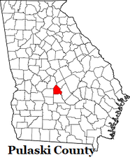
Pulaski County
PULASKI 5, (ARROWHEAD CORE), GGS-3511,
PULASKI COUNTY, GEORGIA
Location: in Ocmulgee Wildlife Management area, in far northern Pulaski County, east of the Ocmulgee River, approximately 1.5 miles west of the jct. of Magnolia Road and Ocmulgee Public Fishing Area (PFA) Road, 0.4 miles from the end of Ocmulgee Public Fishing Area (PFA) Road, on the top of a hill on the side of the unpaved road extension, and 0.3 miles south of a large dammed pond/lake.
Latitude N 32° 22.830’
Longitude W 81° 29.229’
Elevation 334 Feet
Depth 1,527 Feet
Core Log by Paul Huddlestun
Logged - ca. 1982 Written up – 3/2/14
Notes;
This hole, being planned as a water monitoring well, resulted in the drillers more interested in making hole and not so much making core. As a consequence there’s a lot of hole (gaps) and not much core in the sandy intervals/formations. Back when I first logged the core I didn’t pay much attention to filling in the gaps on the strip logs and leaving it to me to infer lithologies at a later date. Not a good idea! As time went by I paid much more attention to the positions of the gaps as well as the recovered core. Back then, if I needed to make adjustments, just go back to the core boxes and make the adjustments. However, as time went by the load became heavier and heavier and time became shorter and shorter. Only on a few sections of cores have I had the time to make later adjustments. So now I pay the price. But then, I’m now retired so I have plenty of time on my hands, right? Wrong; after retirement, time was just as dear as it was before, if not more so. And at this age, the light at the end of the tunnel is getting darker and darker and I keep running faster and faster.
Anyway, here is the core log and it really is valuable. I hope people really inhale these logs. But then, I think that some will but most won’t. The GGS bulletin that I have really used the most so that now it is dog-eared and tattered is Herrick’s 1961 bulletin on the Coastal Plain well logs of Georgia. That bulletin was really a gift to people interested in Georgia geology and stratigraphy.
| arrowhead_core_tt.docx | |
| File Size: | 68 kb |
| File Type: | docx |
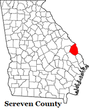
Screven County
SCREVEN 7, GGS-1175
SCREVEN COUNTY, GEORGIA
Burtons Ferry Landing 7½’ Quadrangle
Approximately at the junction of Old River Road and Bay Road, 1.6 miles south of jct. Old River Road and US 301 In eastern Screven County, GA
Latitude 32° 54.833’
Longitude 81° 31.145’
Elevation 85 Feet
Depth 301 Feet
Paul Huddlestun
Logged – circa 1973
Redrawn – 7/90
Written up 10/09
Notes(29/May/2021):
Thomas:
Here’s the Screven 7 log. I picked it out especially for you. It contains the best Ocmulgee Formation section in the Savannah River area and is very enlightening, as is the rest of the Upper Eocene. I have gotten good planktonics out of the Ocmulgee and, surprisingly, the Griffins Landing. In fact, the planktonics in the Griffins Landing are the richest suite of any cores/outcrops of the Griffins Landing I have come across. They, of course, contain a good post-Moodys Branch suite that is very much of interest to me. It is more similar to the Upper Jackson forams than is the planktonic forams of the Moodys Branch. That suggests a significant gap of one sort or another between the Moodys Branch and the North Creek/Dry Branch/Twiggs. I can’t tell if the gap is a time gap or a relatively fast evolutionary adjustment during the early Jacksonian. I also have no biostratigraphic information of the presence of the Moodys Branch, real stratigraphic position in Georgia. Much earlier I thought is was the Tivola but later, I became more circumspect. I became more convince that the Tivola is more likely to be a calcareous lithofacies of the Twiggs (and therefore North Creek) after my last visit with you at the lime pit south of Clinchfield that I cannot find on the modern map, nor the name of the road that escapes me right now. However, it is still possible that the Tivola is Moodys-equivalent but I haven’t found a Moodys foram suite anywhere in Georgia yet. On the other hand, the Cockspur Island core below Savannah, within view of Fort Pulaski and taken by the USGS in 2009 I think, contains a section within the lower Jackson, Williston Limestone that is virtually identical to the characteristic calcareous lithology of the Moodys Branch-equivalent in central Alabama. So; I am still uncertain of the presence or lack of the presence of Moodys Branch-equivalent deposits in Georgia. In the older literature, prior to the 1970’s, the “Scutella” bed was considered to be Moodys Branch. That’s what I was told when I was doing my Master’s in Alabama in the mid 1960’s, but later found that the “Scutella” bed is really Gosport, that the Gosport/Moodys contact was misidentified in 1940. The typical Moodys Branch, overlying the Middle Eocene Gosport, does not contain any profusion of Periarchus so what “species” of Periarchus typical Moodys Branch contains is unknown to me. However, I think searching for Periarchus in the Moodys would likely end in failure and frustration; the Moodys generally contains planktonic foraminifera where the sediment can be disaggregated. Planktonic foraminifera and sand dollars of any kind don’t like each other; they thrive in quite different environments.
Another interesting feature of the Screven 7 core is that it contains a lithological and biostratigraphically identifiable basal subdivision of the Ocmulgee Formation that can be reasonably correlated directly to the Pachuta Marl of Alabama and Mississippi. The Pachuta in that area is a basal, marly transgressive phase of the upper Jackson that, where you get a reasonably good suite of planktonic forams, contains Globigerinitheka tropicalis. G. tropicalis is a late, early Eocene through lower Jackson species that extends into the Pachuta Marl in Alabama and Mississippi but is apparently extinct in the upper Jackson. G. tropicalis is present in the Pachuta-equivalent, lower, marly clay phase of the Ocmulgee Fm in the Screven 7. Lithostratigraphically, this lithologic phase of the Ocmulgee can be identified at a few other outcrops and cores, including the type locality, but the sediment is normally too consolidated to concentrate foraminifera. Fortunately in the Screven 7, it is nonindurated and contains a “reasonably” diverse suite of planktonics; this is, the suite is diverse enough to contain stratigraphically significant species/forms. The suite in the Screven 7 is not anywhere as large and diverse as it is in Alabama and Mississippi.
So next I will forward the Cockspur Island core log to you. It is relatively deep for Chatham County and the Savannah area but it contains a complete section of the Upper Eocene through Holocene and an almost complete section of the Middle Eocene. After that I will forward more core logs from Burke and Screven Counties to you so that the entire Upper Eocene section from relatively nearshore, Upper Eocene to far offshore (but still relatively shallow water) Upper Eocene will be presented. Unfortunately the Ocmulgee doesn’t grade laterally seaward into the Crystal River Formation in the lower Atlantic Coastal Plain but into the bryozoan limestone equivalent of the Crystal River. For some reason the Williston Limestone remains the Williston but contains a more varied granular/pelletal limestone lithology.
| screven_7_ggs-1175.doc | |
| File Size: | 55 kb |
| File Type: | doc |
Screven County
GEORGIA POWER, B-31
SCREVEN COUNTY, GEORGIA
Brier Creek Landing 7½’ Quadrangle
On the side of Pine Grove Road, approximately 0.25 miles north of Brannon’s Bridge over Brier Creek, in eastern Screven County, GA
Latitude 32° 48.764’
Longitude 81° 28.844’
Elevation 70 Feet
Depth 248.2 Feet
Paul Huddlestun, March 1973
Written up – 11/11/11
Thomas:
The B31 and the others that will be coming from Screven County give you some kind of an idea how the Ocmulgee grades into the bryozoan limestone. I wish I could see how the Ocmulgee grades into whatever limestone is seaward of it in central Georgia. This core took me only an hour to edit and adjust; whoopee!
Paul
| georgia_power_b31.doc | |
| File Size: | 44 kb |
| File Type: | doc |
Screven County
GEORGIA POWER CORE, B-33
SCREVEN COUNTY, GEORGIA
Burtons Ferry Landing 7½’ Quadrangle
On the side of Old River Road, approximately 1.8 miles north of junction of Old River Road and US 301 in eastern Screven County, GA
Latitude 32°°57.475’
Longitude 81° 32.484’
Elevation 115 Feet
Depth 273 Feet
By Paul Huddlestun, May 1973
Transcribed 11/4/2011
| georgia_power_b33__1_.doc | |
| File Size: | 46 kb |
| File Type: | doc |
Screven County
GEORGIA POWER CORE B-34
SCREVEN COUNTY, GEORGIA
Millett 7½’ Quadrangle
Approximately 0.6 miles straight south of jct. of River Road and Stony Bluff Road, and 0.5 miles south of Burke/Screven Counties line, in a field between two large Carolina Bays in northernmost Screven County, GA
Latitude 33° 01.067’
Longitude 81° 34.641’
Elevation 185 Feet
Depth 273.3 Feet
Paul Huddlestun; March, 1973
Written up - 11/2011
Core was disposed of in 1973/1974
| georgia_power_b34__1_.doc | |
| File Size: | 48 kb |
| File Type: | doc |
Screven County
GEORGIA POWER, B-36 (POOR ROBIN LANDING)
SCREVEN COUNTY, GEORGIA
Blue Springs Landing 7½’ Quadrangle
On the side of Poor Robin Road, approximately 1.0 mile east of the jct. of GA 24 and Poor Robin Road, at the foot of the bluff overlooking, and on the Savannah River flood plain, in eastern Screven County, GA
Latitude 32° 41.501’
Longitude 81° 26.509’
Elevation 48 Feet
Depth 173 feet
Paul Huddlestun March 1973
Redrawn – 9/22/09
Written up – 11/11
| georgia_power_b36.doc | |
| File Size: | 43 kb |
| File Type: | doc |
Screven County
GEORGIA POWER, B-37 (POOR ROBIN LANDING)
SCREVEN COUNTY, GEORGIA
Blue Springs Landing 7½’ Quadrangle
On the side of an unimproved, east-west dirt road, approximately 0.3 mile south of the junction of Poor Robin Road and Heather Lane, 0.15 mile west of what appears to be a small Carolina Bay, about 1.1 miles west of the site of core B36, above river floodplain, in eastern Screven County, GA
Latitude 32° 42.291’
Longitude 81° 25.564’
Elevation ~100 Feet
Paul Huddlestun, Logged - 3/73
Redrawn – 9/25/09
Written up – 11/12/11
| georgia_power_b37__1_.doc | |
| File Size: | 50 kb |
| File Type: | doc |
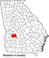
Sumter County
Two Cores:
SUMTER 9A & 9B (DANVILLE FERRY), GGS-3366
SUMTER COUNTY, GEORGIA
Drayton 7½’ Quadrangle
Latitude N 31° 31.127’
Longitude W 84° 06.795’
Elev. 270 Feet
Core depths A) 960ft B) 180ft
By; Paul Huddlestun
Logged - ca. 1979
Written up – 2/12/2014
Core was "...taken less then a mile northwest of the Ga 27 bridge over the Flint River on private property behind the bluff, on the river that exposes the Lisbon Formation."
| sumter_9a__ggs-3366__danville_ferry__2_.doc | |
| File Size: | 81 kb |
| File Type: | doc |
| sumter_9b__ggs-3366__danville_ferry.doc | |
| File Size: | 33 kb |
| File Type: | doc |
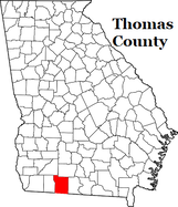
Thomas County
THOMAS 4 (BOSTON CORE),
GGS 3188, U.S. GYPSUM 76-1
THOMAS COUNTY, GEORGIA
2½ miles northeast of Boston, GA
Boston 7½’ Quadrangle
Latitude N 30° 48.658’
Longitude W 83° 45.406’
Elev. 200 Feet
By; Paul Huddlestun Logged ca. 1977
Finished logging – 4/13
Mostly written up – 10/7/11
Completed – 6/14/13
This is a significant core, like Thomas 6; it is immediately south of the southern rim of the Gulf Trough, southeast of Moultrie. Unfortunately, there are not enough cores to determine exactly where the boundary of the southern axis of the Gulf Trough is in the area. It may be under Moultrie. The axis appears to be at least 10 miles across, probably similar to Florida.
| thomas_4__boston_core_.doc | |
| File Size: | 137 kb |
| File Type: | doc |
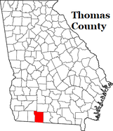
Thomas County
THOMAS 5, GGS-3207, U. S. GYPSUM 76-9
THOMAS COUNTY, GEORGIA
Between Coolidge and Pavo, 3½ miles east of Coolidge
Patten 7½’ Quadrangle
Latitude N 30° 59.400’
Longitude W 83° 48.555’
Elevation 238 feet
Core depth 1206 feet
By; Paul Huddlestun Logged ca. 1977
Finished logging 11/13-16/12
Finished writing up 12/12/12
Download below
| hud_core_thomas_5.doc | |
| File Size: | 148 kb |
| File Type: | doc |
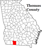
Thomas County
THOMAS 6, GGS-3215, U. S. GYPSUM 76-11
About 2.5 miles east of Coolidge, Thomas County, Georgia, About 0.1 mile north of Japonica Rd, in a field northwest of a farm Coolidge 7½’ Quadrangle
Latitude N 31° 00.130’
Longitude W 83° 49.636’
Elev. 245 Feet
Depth 801 Feet
By; Paul Huddlestun
Logged ca. 1977
Written up – 7/19/11
| thomas_6__e_of_coolidge___1_.doc | |
| File Size: | 91 kb |
| File Type: | doc |
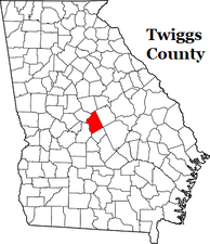
Twiggs County
TWIGGS 2 (JEFFERSONVILLE CORE), GGS-3174
TWIGGS COUNTY, GEORGIA
Jeffersonville 7½’ quadrangle
Approximately 1.2 miles west of Jeffersonville in Twiggs County, Georgia, on the south side of highway US 8o/Ga 19, and at a bend in the road
Latitude N 32° 28.566’
Longitude W 83° 57.081’
Elev. 538 Feet
Depth 331 Feet
Paul Huddlestun
Logged ca. 1979
Written up – 6/29/14
| twiggs_2__jeffersonville_core__tt_ggs-3174.doc | |
| File Size: | 61 kb |
| File Type: | doc |
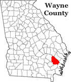
Wayne County
USGS DAVIS-HOPKINS #1, GGS-3176
WAYNE COUNTY, GEORGIA
Bug Island 7½’ Quadrangle
Latitude: N 31° 32’ 47”
Longitude: W 81° 43’ 57”
Elevation: 75.2 Feet
Depth Logged: 1987.35ft
Note;
Danian Stage (of Paleocene) at 2011 feet and 2026 feet according to reliable sources! With the KT Boundary: at 2041-2150 feet according to other reliable sources! End of core logging at 1987.35 feet in 2010: ran out of time. Got tired and wanted to get out and go home!
Core; Paul Huddlestun
Logged 4-79
First written up 2-8-96
Rewritten 4/5-09
Updated – 7/15/10
Immediately off of Gardi Road, 0.8 miles west of the junction with Paradise Park Road
| davis-hopkins_core_log.doc | |
| File Size: | 148 kb |
| File Type: | doc |
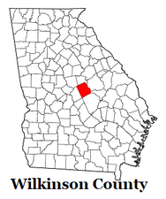
Wilkinson County
WILKINSON 2 (TOOMBSBORO CORE), GGS-3175
WILKINSON COUNTY, GEORGIA
Toomsboro 7½’ quadrangle
Approximately 2.5 miles west of the junction of Main Street and GA 57 in Toomsboro, Wilkinson County, Georgia, near the junction of Highway GA 57 and Poplar Springs Church Road
Latitude N 32° 48.599’
Longitude W 83° 07.136’
Elev. ~460 Feet
Depth 300 Feet
Paul Huddlestun
Logged ca. 1979
Written up – 7/1/14
| wilkinson__2__toombsboro_core__tt.doc | |
| File Size: | 59 kb |
| File Type: | doc |
